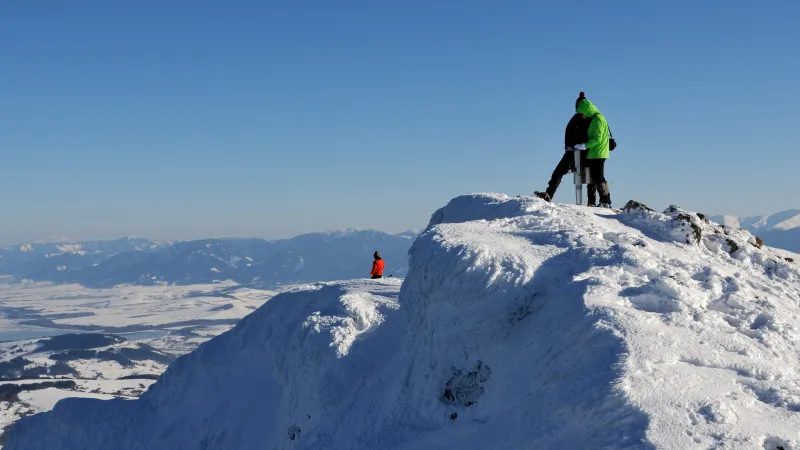
Vápeč (956 m) may not impress with its elevation, but its rocky summit offers beautiful views of the surrounding hills, forests, meadows, and the village of Horná Poruba lying right below.
Hike up Vápeč
From the
Horná Poruba, za hôrkou trail junction (440 m), follow the red trail markers, which lead with a gentle climb to the meadows above the village. About 600 metres from the start of the hike, you will reach a junction by a small blue building; turn left here, and at the next junction turn left again. After another 600 metres, you will come to a spring on the left. Just beyond it, the marked route turns onto a path to the left and climbs at first moderately, then more steeply through beech forest to the
Nad Hornou Porubou junction (700 m).
Beyond the junction, a short steep section leads to the first right-hand bend, where there are several benches and a weak spring. From here, the path climbs gently below rocky outcrops teeming with lizards, and now and then views open up on the right. After about half a kilometre, the trail gradually bends left and climbs more steeply to
Palúch saddle (900 m).
From the saddle, it is only a few minutes and a few dozen vertical metres to the rocky summit of Vápeč. Just below the top, you will come across a tiny cave that serves well as shelter in bad weather. You can continue straight past it to a small platform with the summit register, or turn left there and follow the marked path up to the cross on the actual summit.
The descent follows the same route back to just below the
Nad Hornou Porubou junction, where you turn right onto the blue trail. There is no signpost at this turn, and it is marked only by a few blue arrows on the trees, so pay close attention to the waymarks. About 300 metres after the turn, the path splits in two. Keep right, then after another half kilometre cross a logging track and continue descending on a forest path. Just below the track, do not miss the left turn and continue across the meadows above the village, still following the blue markers, until you reach the first houses and the asphalt road. Turn right and after 100 metres you will come to the
Horná Poruba, bus junction, which is only 350 metres from the starting point at
Horná Poruba, za hôrkou.
Useful info
By train to Považská Bystrica or Trenčín, then continue by bus to Ilava, getting off at the stop by the hospital (“Ilava,,nem.”), where you change to a bus to Horná Poruba. Get off at the second-to-last stop (“Horná Poruba,,u Brdárov”), near the Horná Poruba, za hôrkou trail junction.
Search connections
By car, drive to Ilava (take exit 145 from the motorway) and at the roundabout turn toward Prievidza. After just under 7 kilometres, turn left to Horná Poruba and drive through the village to its far end. You can park at the very end of the village by the bus terminus and walk back a few hundred metres to the trail junction.
Horná Poruba, za hôrkou

Nad Hornou Porubou (1:00)
Palúch saddle (1:35)

Vápeč (1:40)
Palúch saddle (1:45)
Nad Hornou Porubou (2:15)

Horná Poruba, bus (2:45)