Babia Hora is the highest peak of the Orava Beskids (1,725 m) and is overlooked by most hikers. One reason is that getting here without a car is not particularly easy. But the deep Orava forests and uncrowded landscape are well worth the trip. Not to mention that there are only a few places in Slovakia where you can see the north faces of the High and Western Tatras…
Ascent of Babia Hora
From
Oravská Polhora, follow the road towards
Slaná voda (755 m). Shortly after the climb above the village, beautiful views open up of the
High Tatras,
Western Tatras, and the
Orava Reservoir. It is about a 45-minute walk from Polhora to the Slaná voda mountain hut along an asphalt road. From the junction by the hut, continue on the yellow-marked trail into the forest, where a very gentle ascent begins. After half an hour of walking, you leave the forest and reach a broad pasture with a few solitary trees. At the end of the pasture stands a small shelter; just beyond it, at the
Paseky (868 m) junction, you join an asphalt road that ends after five minutes at
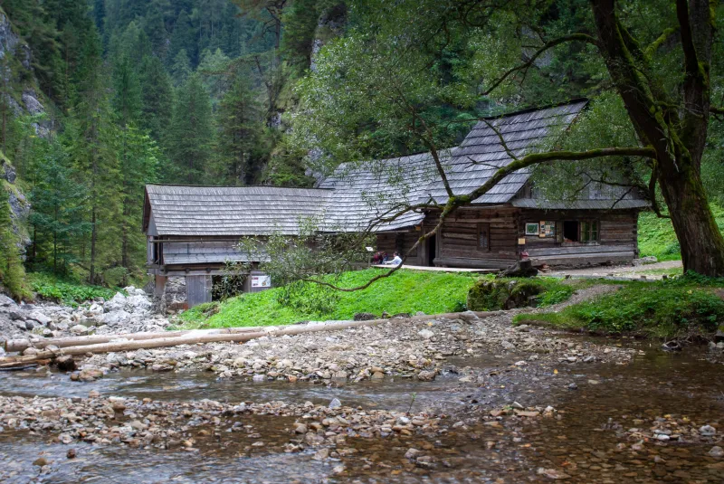
Hviezdoslav’s gamekeeper’s lodge, where the important Slovak poet and writer Pavol Országh, known by the pen name Hviezdoslav, stayed and worked. The lodge now houses a museum dedicated to his work.
Behind the lodge, head towards the lookout tower and continue on the yellow trail into the forest. After a few minutes, you emerge again onto a large logged clearing, where you join a wide track. After a few dozen metres, turn left again and climb steeply for a few minutes into the forest, where the path then undulates only gently. A stream flows along the valley bottom on your left, and you follow it until you reach one of its tributaries, which you cross on a wooden footbridge. This brings you to a wide, muddy timber loading area.
On the far side of the loading area, continue up a steep path for about 200 vertical metres, cross another forest road on a large clear-cut with another lookout tower, and follow the stone-paved trail uphill towards the forest. Not far beyond the forest road, you soon come to a shelter at the
Šťaviny (1,275 m) junction. From the shelter, the trail climbs steeply for another ten to fifteen minutes before turning right and easing off. Here, the forest gradually gives way to dwarf pine, and magnificent views begin to open up to the southeast towards the High and Western Tatras. Along the way, you will pass a shelter with a small loft accessed by a ladder—an excellent spot for an emergency overnight stay. Right next to the shelter is a spring.
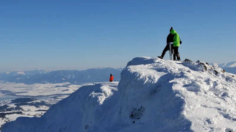
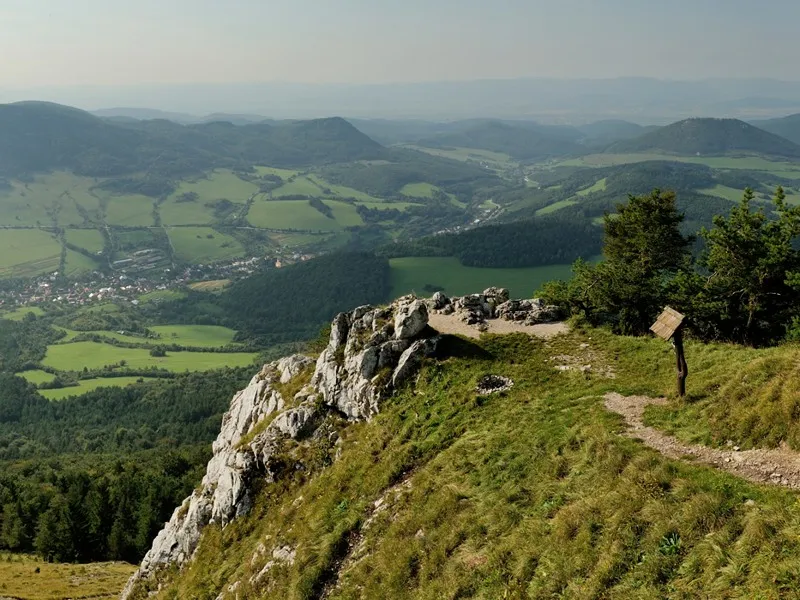
Views from Babia Hora
Not far from here, there is another shelter in the dwarf pine beside the trail. Near it, the path bends sharply left, and only the final climb to the summit of
Babia Hora remains. The summit is fairly broad, and in good weather it offers excellent views of all the higher Slovak mountain ranges: the
Belianske Tatras,
High Tatras,
Western Tatras,
Low Tatras,
Veľká Fatra, and
Malá Fatra. Strong winds are very common here, and you can shelter behind a stone wall built for exactly that purpose. You will not meet many people on the ascent, but the summit itself is often busy. Trails also lead up from the Polish side, and Babia Hora’s popularity with Polish hikers is underlined by the fact that Pope John Paul II also visited the summit.
Malá Babia Hora
Continue west on the blue-marked trail, descending to the saddle below Babia Hora. The first few metres are steep, followed by a very gentle descent with steep northern slopes on your right. As soon as you enter the belt of dwarf pine, the trail drops steeply all the way to the saddle at 1,400 metres. Here you can rest before the short climb of about 110 vertical metres to the summit of
Malá Babia Hora (1,515 m).
From Malá Babia Hora, all that remains is the descent through the forest on the red-marked trail into the valley of the
Vožnovec stream. During the descent, at around 1,200 metres, you will come across a shelter with a loft. It is not in good condition, but it can be useful in bad weather. Not far from it, some maps show a spring that used to be improved and usable, but now there is only mud.
A short distance beyond the shelter, you reach a wider track, which you soon leave again to the left at the
Borsučie signpost. Descend about 100 vertical metres until you reach a broad track on the valley floor. Continue along this track, still following the red markers, for about five kilometres via the
Pod Borkom and
Vonžovec junctions to the Slaná voda mountain hut. Here you can spend the night or continue back to Oravská Polhora.
Translation note:
This text was automatically translated from Czech. The original route description is based on personal experience.
Useful info
First, you need to get to Námestovo, a small town on the shore of the Orava Reservoir. There are buses here every few hours from Kraľovany (a railway stop on the Bratislava – Košice line), twice daily from Bratislava, once daily from Poprad, and four times daily from Banská Bystrica. From Námestovo, continue by another bus to Oravská Polhora, getting off at the “Oravská Polhora,,Jednota” stop.
Search connections
By car, you can drive all the way to Slaná voda, where there is a free car park in front of the mountain hut.
Oravská Polhora

Slaná voda

Paseky
Hájovňa na Rovniach
Šťaviny
Babia Hora

przeł. Brona
Malá Babia Hora
Borsučie
Pod Borkom
Vonžovec
Slaná voda
Oravská Polhora