Suchá Belá Gorge
- 03:50
- 9.5 km
- 450 m
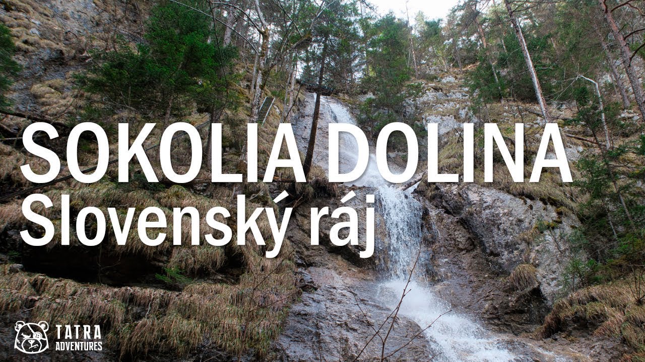
Sokolia Valley is one of the wildest and most remote gorges in Slovak Paradise. Its biggest highlight is the series of exposed ladders and footbridges running alongside the 75-meter Veil Waterfall, the highest waterfall in Slovak Paradise and the second highest in all of Slovakia.
Sokolia Valley joins the Tomášovská Belá gorge about 3.5 km upstream along the Biely potok from the Hornád Gorge Breakthrough. Since this is one of the most remote gorges in Slovak Paradise, it takes a while just to get to the mouth of Sokolia Valley. There are several approach options:
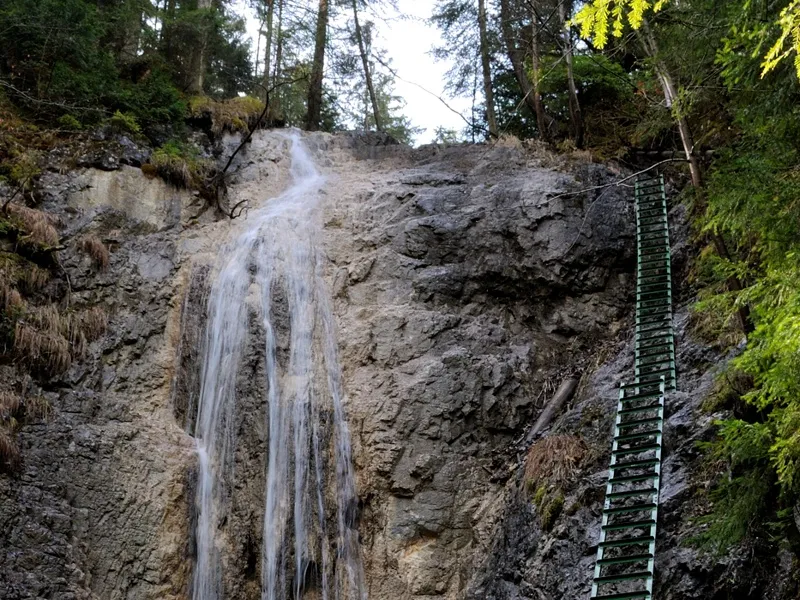
The ascent through Sokolia Valley itself starts at the Sokolia dolina, ústie (569 m) junction, where you follow the yellow trail on a gently rising path that mostly runs through the rocky streambed or right beside it. After about twenty minutes you reach Skalný Waterfall, which is bypassed by a metal ladder on the left.
A short way above the waterfall, the path begins to climb more steeply and turns left along an increasingly high rock wall. After a while it bends right, and the view opens up to the 20-meter lower tier of Veil Waterfall together with the first long ladder.
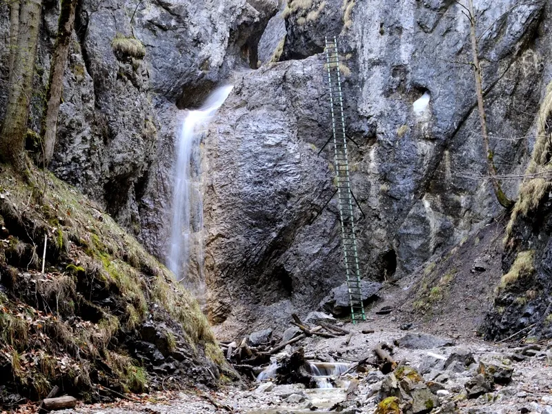
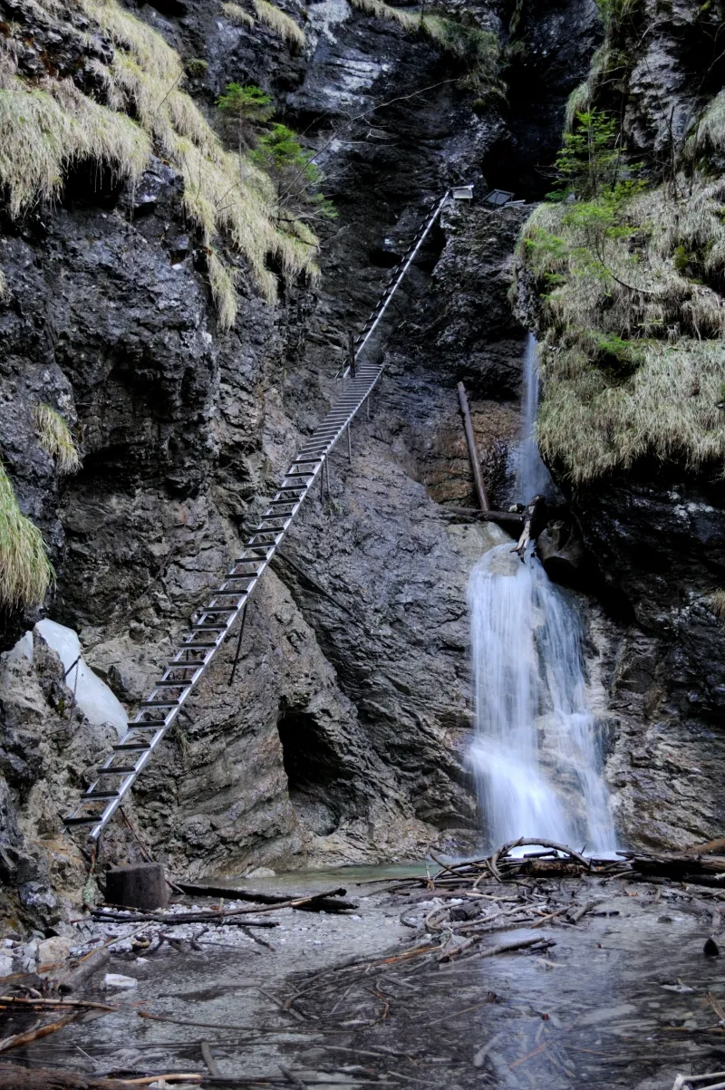
After climbing it, you cross a footbridge to the other side of the waterfall and continue up another system of ladders that tackles a long, very steep grassy slope to a second footbridge. Above it, only a few iron steps and a short ladder beside the final short drop remain, and then Veil Waterfall is behind you for good.
This is followed by a short narrow gorge, and within a few minutes you find yourself below Vyšný Waterfall. You can get directly beneath it by a series of walkways and iron steps. Along the waterfall, a long ladder leads you above the rock wall, where you transfer to a shorter ladder and overcome the last steep section. This climb marks the end of the demanding part of Sokolia Valley, opening into its broader upper section with beech forest and a quietly flowing stream.
WARNING: The ascent along Veil Waterfall is very long, exposed, and dangerous, as only your own sure-footedness stands between you and a long fall to the bottom of the Sokolia gorge. It is definitely not recommended for anyone suffering even from mild vertigo.
Finally, the yellow trail brings you to the forest road at the Sokolia dolina, záver (1,002 m) junction, where you can rest on benches at a table under a shelter. Take the green trail left to the pod Bykárkou (1,000 m) junction, then descend on the yellow trail back into the Tomášovská Belá valley to the Klauzy Reservoir (643 m).
Until 1950, the Klauzy Reservoir was still used for floating timber down to Smižany. For most of the year, the low water level in Biely potok did not allow log driving, so when needed, the sluice gates were opened and the flow was temporarily increased.
At the reservoir, you can refill water from the spring. To return to the mouth of Sokolia Valley, follow the green trail downstream.