Sveto Brdo – ascent to Velebit’s second-highest peak
- 06:00
- 15.5 km
- 1200 m
The southern Velebit traverse is a demanding and breathtaking ridge hike across the wildest part of Croatia’s Velebit range, combining mountain wilderness with sea views. This four-day route offers an unforgettable experience of raw nature, leading over the highest peaks, past abandoned hamlets, through deep forests, and to cozy mountain shelters.
The ascent to the Velebit ridge starts near the coast in the hamlet of Modrič, close to the village of Rovanjska and not far from the well-known Paklenica canyon. There is a bus stop in Modrič and a small free parking area right next to it where you can leave your car.
The marked trail leads above the settlement and continues on a well-maintained path winding between rocky outcrops and scrub.
After about 200 meters of ascent, you cross a gravel road and pass through the abandoned hamlet of Stanići, with its crumbling stone houses and terraces.
This is followed by a steep climb of roughly 400 vertical meters through sparse woodland to broad pasturelands, where you join a gravel road for off-road vehicles. After just under a kilometer and a half, turn left and continue over gently rolling terrain to the remains of the church of Sveti Ivan. Nearby is a muddy watering hole that can serve as an emergency water source if filtered.
It is easy to lose the correct path behind the church, so pay close attention to the trail markers and your GPS. From here the route climbs gradually along the slope, with a broad plateau on your right, up to the Iza Čovika saddle (1,008 m).
At the saddle the trail bends left onto the slope and continues steeply up to another saddle at 1,293 m. Beyond it, the route skirts a large sinkhole on the left and shortly after descends into a smaller one.
Just beyond the last sinkhole is a small meadow with the cozy Dušice mountain shelter (1,262 m), and just behind it there is also a covered spring.
The Dušice shelter has two rooms: a sleeping room with bunks and a small kitchen with a dining table. Outside the shelter there is a large table and a big fire pit. On the meadow in front, you can find a few flat spots for tents.
The first day of the southern Velebit traverse takes you from the coast up into the mountains, through abandoned hamlets and grassy plateaus to Dušice shelter — a perfect first taste of the Velebit ridge.
The second day begins with a short climb to the saddle above the shelter, followed by nearly level ground across a mountain meadow. But this soon turns into a steep ascent up the slopes of Sveto Brdo, first through beech forest and later across grassy terrain with occasional rock outcrops.
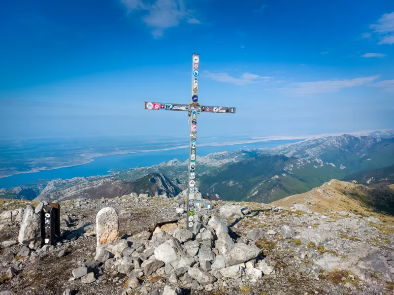
The climb ends at the summit cross on top of Sveto Brdo (1,751 m), which offers magnificent views not only of the sea and islands, but also of the Velebit ridge and the inland mountains. If visibility is good, you may even spot Dinara (1,831 m) to the east — the highest mountain in Croatia.
A descent of about 250 vertical meters follows to a saddle, from where it is possible to descend to the Vlaški Grad shelter.
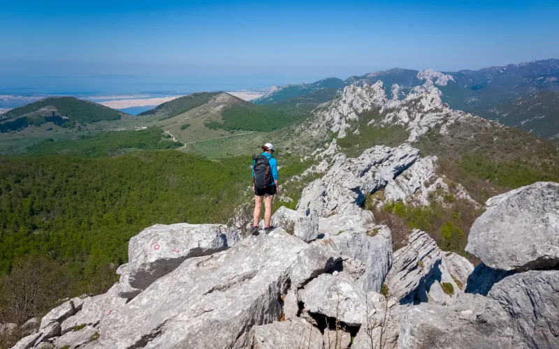
Next comes a long undulating ridge traverse, at first through grassy terrain with one scree section. After the Čičina dolina junction, the trail moves onto the inland side of the ridge, where you will mostly walk through dwarf pine.
You pass through Malovan Saddle (1,623 m) and the turnoff to Brundo Peak (1,716 m).
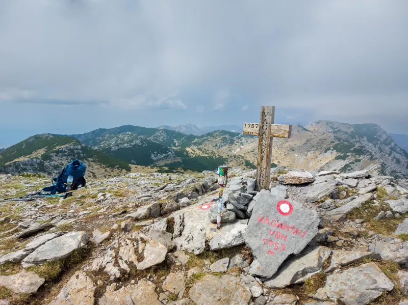
After countless small descents and climbs, which this section from the saddle below Sveto Brdo is full of, you eventually ascend grassy slopes to the highest peak of Velebit — Vaganski Vrh (1,757 m).
Vaganski Vrh is also an outstanding viewpoint, not only over the sea but along the Velebit ridge itself. Once you have had your fill of the views and a good rest, it is time for an easy descent to the Marasovac well and then on to Struge shelter. If you want to end the stage here, you must carry all the water you need for the evening and next morning from the well — there is no spring at Struge shelter itself.
Beyond the shelter, an easy path leads to Buljama saddle (1,394 m), with fine views of the valleys and forests below. From the saddle, a steep descent through rocky terrain leads to a junction at around 1,100 m above sea level, from where it is possible to descend to Paklenica mountain hut (480 m). Our route continues right, traversing past the seasonal Zanzibar spring to Stražbenica saddle (1,130 m), where there is also a strong water source.
Continue on a gentle descent to the broad Veliko Rujno plateau at about 900 meters. On the way, make sure to look over the edge of the deep Jama Golubinka pit. Around the settlement of Gornji Marasovići stands the little church of Velika Gospa, next to which there is a well with water. The surrounding area has plenty of flat pasture, so finding a tent spot is easy.
The second stage is the heart of the Velebit ridge traverse — with the ascents of Sveto Brdo and Vaganski Vrh, it brings the highest points of the whole crossing and the grandest views of both the Adriatic and the inland mountains.
Today’s stage begins with 4 kilometers of almost flat walking across pastures with cows, horses, and sheep. The trail starts climbing gently near the abandoned homestead of Marikovića stan, then leads you through meadows and forest over countless short ups and downs, past the Račabuša homestead, the turnoff to Špilja Vrtlina cave, and the turnoff to the Stone Gallery.
It was on this section that we came across four nose-horned vipers basking in the morning sun. You really do need to keep watching where you step and occasionally hop aside. The nose-horned viper is more venomous than the common adder, but it is not usually aggressive and will generally try to hide quickly when you approach.
The approach to the Stap plateau, where Tatekova Koliba shelter (860 m) stands, is marked by a climb to a striking rocky outcrop shaped like a rounded cone, from which there are lovely sea views. This is followed by a steep descent to the plateau and the shelter.
Tatekova Koliba is surrounded by trees that provide pleasant shade around the outdoor table. For overnight stays there is one sleeping room and a raised loft in the main room. There is plenty of room for tents in the meadows below the hut. In the main room you can light the stove, and there are USB charging ports powered by a solar panel on the roof. A short distance from the hut there is a hand pump for water.
If you are lucky, you may spot young newts in the pools below the spring, or even a grass snake.
Beyond the hut, a shorter climb and another stretch of rolling terrain, mostly in the forest, await. A steep ascent of about 100 vertical meters brings you to a small grassy saddle with a view of Panos (1,258 m). To reach it, however, you first have to descend into the forest and then climb about 200 vertical meters to an old military road leading to the summit.
At the top of Panos there is an old military radar and communications station. Visiting the structures is generally not recommended, as they are in very poor condition, there is a risk of falling into underground spaces, and the presence of mines in the surrounding area cannot be ruled out. If none of that puts you off, nothing is stopping you…
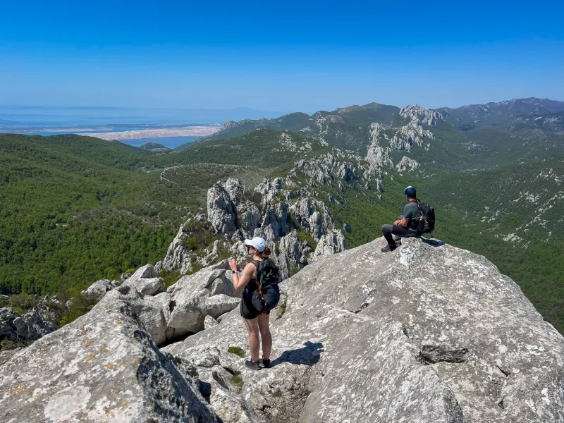
Otherwise, continue for about half a kilometer along the old road, then leave it at a sharp right-hand bend onto a footpath and continue through the forest to below Brdašce (1,243 m), where a beautiful panoramic section begins, with sea views that make it hard not to stop for a few photos.
If you still have enough time and energy, you can choose the harder but much more beautiful route over Veliki Stolac (1,406 m). The easier option traverses its southwestern slope to Šugarska Duliba shelter (1,212 m). About 100 meters before the shelter, in the forest next to the remains of a building, there is a well with water.
Šugarska Duliba is a brand-new modern shelter with two glass walls, a stove, a regular power socket, and USB ports for charging phones. There is not much room nearby for pitching a tent, so if more people gather here, it is better to go back to the well area, where there are more flat spots.
Day three of the southern Velebit traverse is among the wildest — expect quiet pastureland, forest climbs, vipers on the trail, and a night in a modern shelter below Veliki Stolac.
The descent to Baške Oštarije is long and mostly leads through forest, with fallen trees and some slightly overgrown sections. Even so, as on the rest of the Velebit traverse, the trail marking is generally good and navigation is not a problem.
The final stage takes roughly 6–7 hours, and you should count on around 800 meters of ascent. Fill up with enough water from the well near the shelter, as there is no more water on the way.
In Baške Oštarije you descend directly to a restaurant with excellent food. There is no shop here.
There are modest accommodation options nearby, and in the wider area plenty of places to camp. Depending on what time you arrive, you can catch a bus or hitchhike down to the coast to Karlobag and stay there overnight.
From Karlobag, you can then again take a bus or hitchhike along the Adriatic Highway via Starigrad (Paklenica) back to Modrič and your car.
The final stage of the southern Velebit ridge traverse is defined by a long descent, forest tracks, and a return to civilization — the crossing ends in Baške Oštarije, with the option of continuing on to the coast.
The southern Velebit traverse is an ideal choice for experienced hikers looking for a multi-day ridge walk away from busy trails. This part of the Velebit range offers an exceptional mix of rugged nature, mountain views, and solitude. If you are planning a Velebit crossing, the southern section will win you over with its landscape and atmosphere.
Drive to the small parking area next to the bus stop in the village of Modrič.
You can reach Modrič by bus from Zadar or from the nearby tourist town of Starigrad (Paklenica). In the timetable, look for the neighboring village of Rovanjska.
Water refill options on the Velebit traverse are very limited. There is usually a spring or water source near the shelters, except at Struge shelter, from where the well is about 20 minutes away. It is wise to carry a little extra water for reserve, especially since the rocky slopes facing the sea can be very hot and water disappears from your bottle quickly.
There is nowhere to resupply food. You may occasionally find a small amount of food in the shelters, but this should only be used in emergencies.
The southern Velebit traverse can also be spread over more days, but then you need to carry even more food. Along the way there are many options to descend to the coast and the Adriatic Highway. In some places you can also drop down from the other side of the ridge into the inland area.