Vaganski vrh – hike to the highest peak of Velebit
- 07:30
- 19.5 km
- 1300 m
Sveto Brdo (1,751 m) is the second-highest peak in the Velebit range and one of the most impressive mountain destinations in Croatia. It offers exceptional views of the sea, the islands, the inland, and Velebit’s rugged main ridge. The ascent leads across beautiful mountain pastures, past church ruins, through mountain passes, beech forests, karst sinkholes, and by two mountain shelters. It’s the kind of hike you won’t forget.
From the gravel road, follow the marked trail, which reaches a solitary house in the middle of the pastures after less than a kilometre. The waymarking briefly disappears here—the path continues to the left of the house, heading north.
After about 200 metres, the markings become reliable again. The trail winds between limestone outcrops and opens onto wide pastures near the remains of Sveti Ivan church (830 m), a photogenic spot with beautiful views of the surrounding peaks. Nearby there is a small muddy watering hole that can serve as an emergency water source (only after thorough filtration).
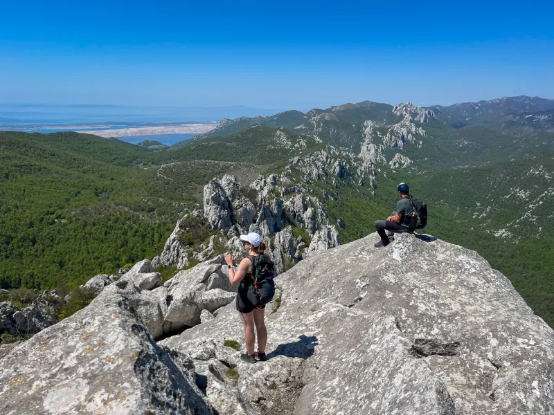
Past the church, extra attention is needed—the trail is not always clearly visible, so it is best to follow both the waymarks and your GPS. The route gradually climbs the slopes above the broad pasture to the Iza Čovika pass (1,008 m). Here it turns left and continues with a steeper ascent to another saddle at 1,293 m. Beyond it, the trail skirts a large sinkhole and briefly descends into a smaller sinkhole overgrown with old beech forest.
Next comes a meadow with the Dušice mountain shelter (planinarsko sklonište) (1,262 m), behind which there is a covered spring. Inside the shelter you’ll find two rooms—a sleeping room with bunk beds and a small kitchen with a dining table and stove. There is a fire pit and benches in front, and camping is possible on the meadow.
Beyond the shelter, the route climbs briefly to a saddle and continues across a grassy meadow. Before long, the steep ascent to Sveto Brdo begins—first through beech forest, later up an open slope dotted with scattered rocks and ever-widening views.
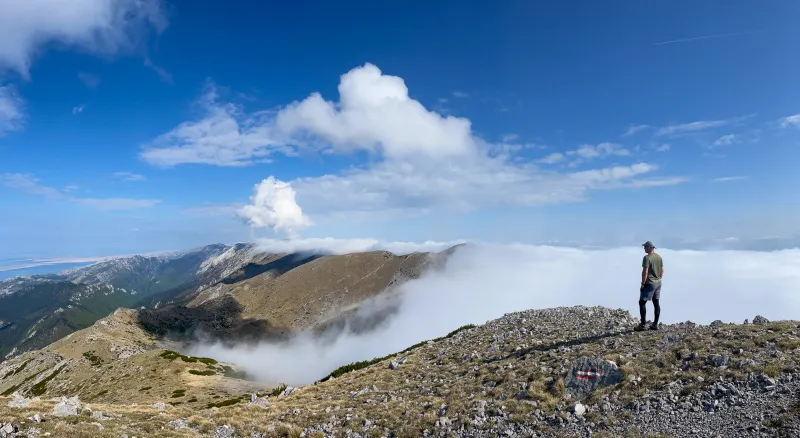
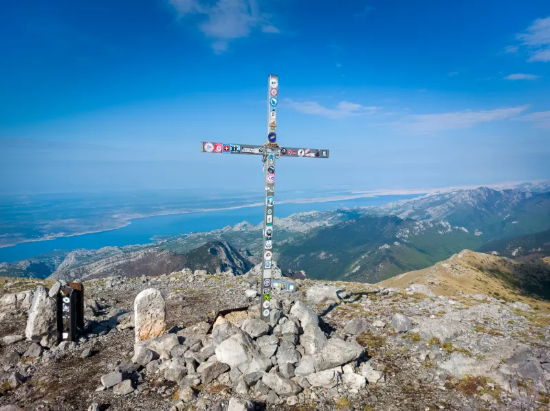
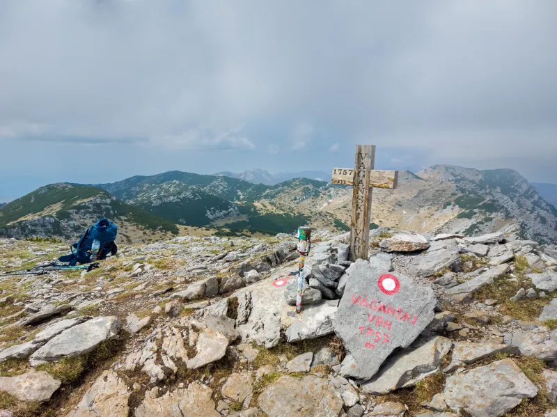
At the top of Sveto Brdo stands a summit cross, and the panoramic view is among the most breathtaking in all of Velebit—over the Adriatic and its islands, inland, and along the main Velebit ridge stretching northward. In the distance, you can also make out the highest peak in the Velebit range—Vaganski vrh (1,757 m).
After a rest on the summit, a steep descent of about 250 vertical metres leads to a saddle, followed by another 200 vertical metres down to the modern Vlaški Grad shelter (1,280 m). A few dozen metres below the shelter, the Donji izvor spring flows from a pipe.
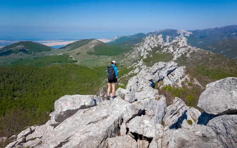
From the shelter, there are impressive views of the steep upper slopes of Velebit, the sea, and the valley above the canyons of Velika and Mala Paklenica.
The descent continues at first gently, then more steeply, back to the plateau with the ruins of Sveti Ivan church, and from there follows the same route back to the starting point.
Access is possible by car via the gravel road from the village of Modrič. A few cars can park by the roadside right at the start of the route; if it is full, there is a slightly larger parking area about 1.5 km farther on. The road is passable in a regular passenger car, though a vehicle with higher ground clearance will handle it more comfortably.
Water can be refilled during the hike to Sveto Brdo from the springs near the Dušice and Vlaški Grad shelters.