Volušnica
- 04:00
- 6.6 km
- 770 m
The ascent of Maja Jezerce is more than just a hike to the highest peak of the Prokletije range. The route takes you past a waterfall, the source of an underground river, and into a magical valley of alpine lakes – natural highlights that make the climb to Maja Jezerce an unforgettable experience.
The hike starts in the Montenegrin village of Vusanje. Before heading into the mountains, stop by Grlja Waterfall, where the stream disappears into a narrow and deep karst canyon. A little farther on, after about 1.5 km of easy climbing through the Ropojana Valley, you’ll reach the impressive Oko Skakavice – a powerful spring fed by an underground river.
Shortly after, you’ll come to a small booth where you pay the entrance fee for Prokletije National Park.
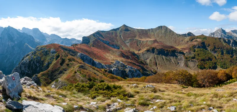
Continue through the valley for about 2.5 km to a junction where the route turns sharply left and begins a steeper climb toward the Zastan shepherds’ hut. Even though the ascent gets tougher here, the track is still passable for off-road vehicles.
The Zastan hut, at around 1350 m, is used by shepherds during the season. Nearby you’ll find a spring – the last reliable source of drinking water. From there, the route continues along a forest path to around 1800 m, where the breathtaking Buni i Jezerce valley opens up.
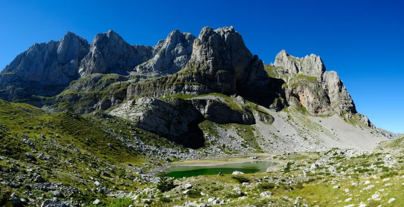
This wide grassy valley, enclosed by steep rock walls, hides six alpine lakes, which partly dry out during summer. The smaller ones dry up completely, so if you want to see them at their best, plan your hike for early summer.
The border between Montenegro and Albania runs near the lakes. According to available information, no permit is needed for a standard day hike, but you should carry valid ID, as checks by border police are possible. If you plan to stay in Albania, a border-crossing permit is required.
After passing the last lake, the trail begins a more pronounced ascent, and soon the first snowfields appear, often lingering here through summer. The route may be less distinct in this section, so at times you’ll have to rely on beaten tracks in the snow and boot marks on the rocks.
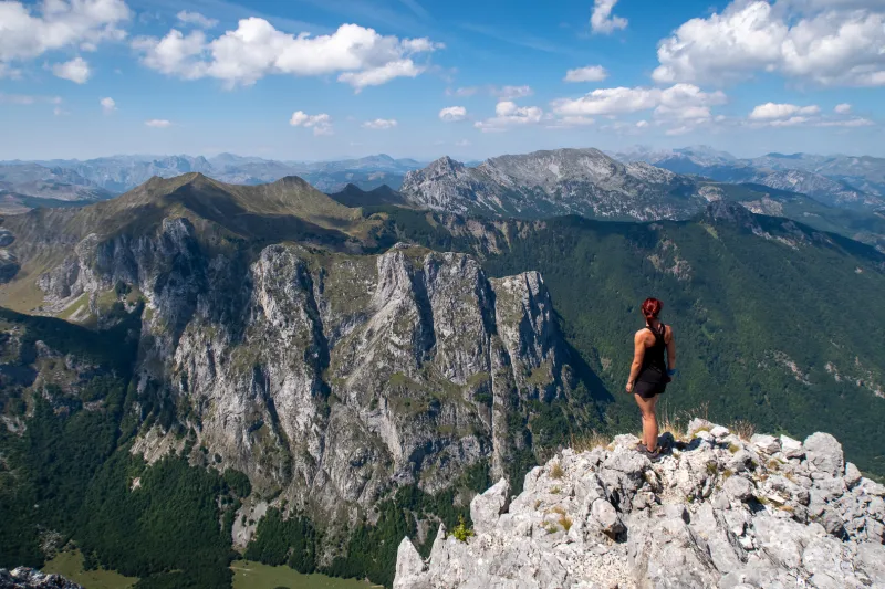
Through this terrain you’ll climb to Prevoj Pass (2270 m), which opens up stunning views into Albania’s Valbona Valley.
From the pass, you begin the actual ascent of Maja Jezerce, the most technically demanding part of the hike. You’ll need to tackle several steep rocky sections, and in many places loose stones shift underfoot.
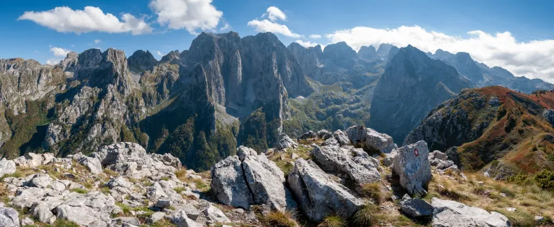
Maja Jezerce (2694 m) has plenty of space for a larger group and rewards you with a panorama that’s hard to put into words – take a look at the photos and judge for yourself.
The descent follows the same route. Take extra care – loose rock is trickier on the way down, and the trail markings may be harder to spot.
By car
Drive through the town of Gusinje to the village of Vusanje, where you can leave your car in the parking area by the Grlja stream waterfall.
By bus
Take a bus to the town of Berane, from where buses run frequently to Gusinje, a small town about 6 kilometres from the trailhead in Vusanje.
You can try looking up timetables here, but treat them as approximate:
Spring above Zastan hut. After that, only filtered water from the lakes or melted snow.