Rysy - summit hike
- 07:45
- 22 km
- 1320 m
People say the hike up Slavkovský Peak is long and demanding. True, you have to climb nearly 1,500 vertical meters, there’s nowhere to refill water, and there isn’t a mountain hut where you can take a break. What gets mentioned less is the stunning panorama waiting at the top, and the fact that there are far, far fewer people here than on the more popular Tatra summits. The ascent is not technically difficult, though.
From the railway station, follow the blue trail through Starý Smokovec to the funicular station for Hrebienok, then continue beyond Smokovec across broad open areas where forest stood before the windstorm of 2004. About 300 metres past the funicular station, turn left and at first gain elevation only gradually. Later, you’ll pass through several switchbacks and reach the Tatra Magistral at the junction rázcestie pod Slavkovským štítom (1,357 m).
Still following the blue trail, cross the magistral and continue on a narrow path climbing gently through the forest until the trees give way to dwarf pine and you reach Slavkovská vyhlídka (1,550 m), also known as Maxmiliánka. The viewpoint has an information board labeling the surrounding peaks, among which the massive Lomnický Peak clearly dominates, rising high above the Malá Studená Valley.
A series of long switchbacks takes you up about 350 vertical metres through the dwarf pine, occasionally opening up to views where the trail leaves the slope and runs along the edge of the ridge. With each additional switchback, the dwarf pine thins out and more rocky ground appears, which you must cross, until both the switchbacks and the pines almost disappear.
From here, the trail climbs steadily along Štrbavý Ridge—or rather along its southern slopes, because on the north side steep rocky walls drop into the depths of the Veľká Studená Valley. Continue along the ridge to below Slavkovský nos (2,273 m), a rocky summit that you bypass on the right, reaching a saddle before the final steeper push up to Slavkovský Peak.
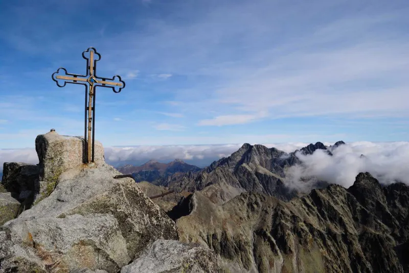
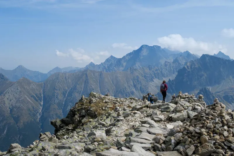
The end of the climb is marked by an iron cross standing on the relatively spacious summit of Slavkovský Peak. Besides Lomnický Peak, which is already clearly visible from the viewpoint, you can also enjoy views of the mighty pyramid of Ľadový Peak (2,627 m), Zbojnícka chalet and the surrounding tarns at the head of the Veľká Studená Valley, as well as Slovakia’s highest mountain—Gerlachovský Peak (2,654 m).
Return to Starý Smokovec the same way.