Rysy - summit hike
- 07:45
- 22 km
- 1320 m
The easternmost peak in the High Tatras, with superb views of the Belianske Tatras. The route to Jahňací štít passes Chata pri Zelenom plese, which together with the lake of the same name and the surrounding steep peaks creates an unforgettable panorama.
From the car park, follow the wide yellow-marked gravel track, which climbs gently through the remains of the forest. From time to time, Lomnický štít appears on the left. As you approach the nad Matliarmi junction (1,020 m), the trees become denser until you leave the storm-damaged area completely behind.
Continue along the same path, cross the Kežmarská Biela voda stream on a wooden bridge, and keep going until you reach a small hut on the right and a spring on the left. A few dozen metres farther on is the Šalviový prameň junction (1,200 m), where the trail turns left and crosses the stream again.
Soon after, you pass the Kovalčíkova polana junction (1,226 m), where there is a larger shelter — the last place to take cover from bad weather before reaching Chata pri Zelenom plese.
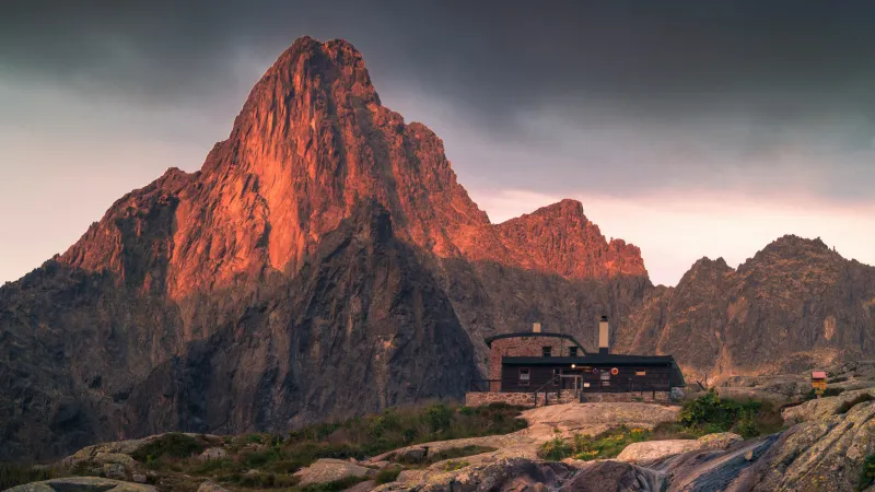
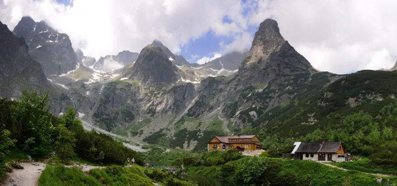
Still following the yellow trail, continue on a gentle climb through the forest, with occasional views of the Belianske Tatras on the right. As you gain altitude, the trees thin out and the views open up, until the breathtaking panorama of Zelené pleso unfolds before you. Above the lake stands Chata pri Zelenom plese, and towering above it are Kežmarský štít, Lomnický štít, Pyšný štít, Čierny štít, the majestic Jastrabia veža, and Kozí štít. All that remains is to cross the footbridge over the stream flowing out of the lake, climb a few more metres, and you are at the hut.
Right behind the hut, a steep climb begins on a narrow path winding through dwarf pine. After about 250 vertical metres you reach Červené pleso, where the slope briefly eases, but soon you start gaining height quickly again toward Kolový priechod (2,118 m) — the point where you step onto the ridge linking Jahňací štít and Kolový štít. Just below the pass, you still have to negotiate several rocky sections secured with chains.
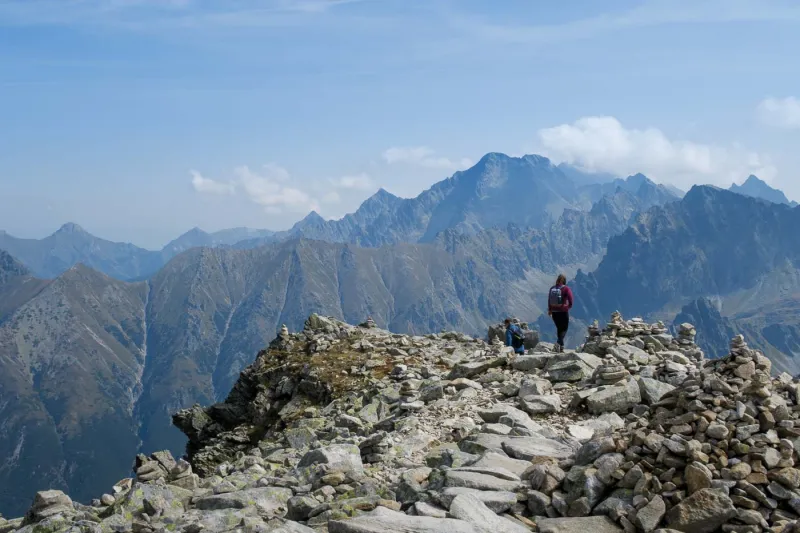
Make a good note of where Kolový priechod lies on the ridge, as it is easy to miss on the way back because the worn path continues well beyond it. From here, the summit is only a little over 100 vertical metres away, but the route is rocky and in places loose with scree, so watch every step. From Jahňací štít (2,230 m), besides views of the surrounding peaks of the High Tatras, the real highlight is the magnificent view of the entire ridge of the Belianske Tatras.
Descend back to the car park by the same route.