Rysy - summit hike
- 07:45
- 22 km
- 1320 m
A hike past Slovakia’s largest mountain lake, Veľké Hincovo pleso, to one of the best viewpoint summits in the High Tatras – Kôprovský Peak (2,367 m), with sweeping views of dozens of surrounding peaks.
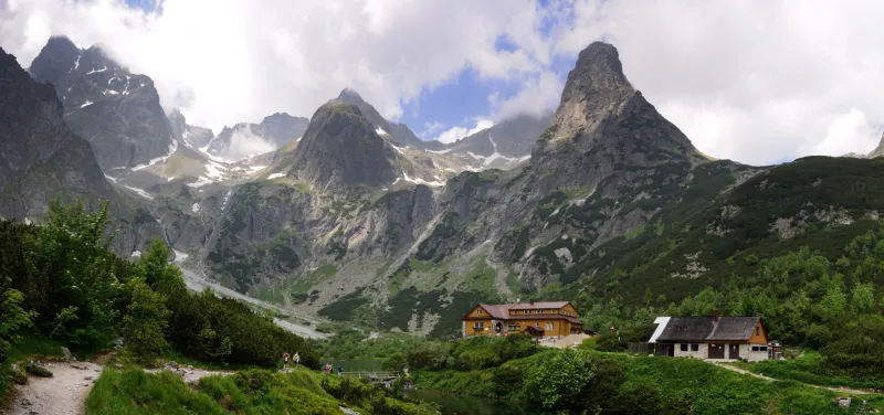
Whether you arrive by train or by car, head to Štrbské Pleso. On the southern side of the lake you will find the trail junction where the hike begins. Follow the red trail, which at first skirts the lake on the right, then soon turns right and after about 200 metres brings you to an asphalt road at the Pred Heliosom junction. Still following the red markers, walk briefly along the road and at the junction just beyond the bridge, odbočka Pri Heliose, turn onto a forest path that climbs gently through the woods to the Trigan junction at 1,499 m. From there the trail undulates only mildly, and the first views open up across to Zlomisková Valley and Ostrva. About a kilometre beyond this junction you will come to a spring, and shortly after it the trail drops briefly to a footbridge over the Hinčov Stream on the floor of Mengusovská Valley. Around 300 metres past the bridge is the Nad Popradským plesom junction (1,500 m), from where you can continue a few dozen metres along the red trail to take a look at Popradské pleso.
From the Nad Popradským plesom junction, continue on the blue trail, which climbs gently through forest and later dwarf pine in Mengusovská Valley. After about a kilometre you will come to an unmaintained spring. Roughly another hundred metres on, you cross the stream by a footbridge where there are benches for a short rest. Just beyond the bridge you pass the Nad Žabím potokom junction (1,580 m) and continue on the blue trail with a gentle climb through dwarf pine for just under half a kilometre, where you cross another stream on stones. Not far beyond, the trail begins its first steep ascent and the elevation starts to build quickly. The climb is broken only occasionally by shorter easier stretches, the last of them crossing a boulder field. One final steeper section brings you onto the broad flat area at the head of Mengusovská Valley, and along its left side the trail leads to Veľké Hincovo pleso (1,946 m), which is 740 metres long and up to 53.7 metres deep.
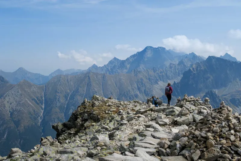
From the signpost at the lake, a few more minutes of easy walking on an almost level path await, with Malé Hincovo pleso appearing on the left, followed by a steep 200-metre climb to Vyšné Kôprovské sedlo (2,180 m). From there it is still about 40 minutes along the red trail to the summit of Kôprovský Peak, gaining nearly another 200 vertical metres.
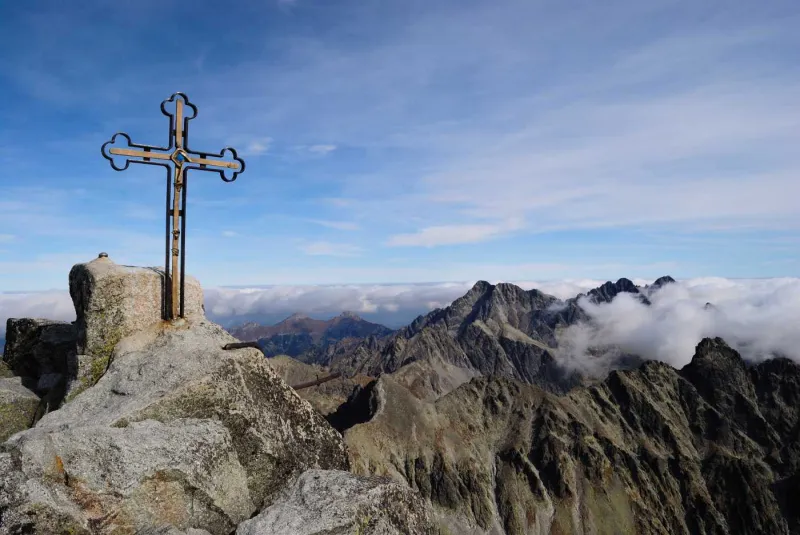
The climb from the saddle to the summit is the most demanding part of the whole hike. In places it crosses rocky sections and boulder fields, where in poor visibility it is easy to lose the correct route. On the ascent you will occasionally need to use your hands, and especially near the top and on the small summit itself you need to watch your footing carefully. Kôprovský Peak is an outstanding viewpoint. Directly below you lies Veľké Hincovo pleso, while the Temnosmrečinské lakes spread out in the neighbouring Temnosmrečinská Valley. Among the peaks you can admire are Rysy, Vysoká, the Mengusovské Peaks, Kriváň, and dozens of other summits in the High Tatras. Farther east lie the Western Tatras, and in clear weather you may even glimpse part of the Low Tatras in the distance to the south.