Velká Fatra Ridge Traverse
- 3 dny
- 48 km
- 2700 m
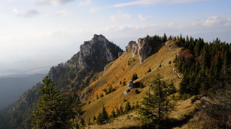
Lysec (1,381 m) stands away from the main ridge of the Veľká Fatra, so only a small number of hikers come here, mostly locals. That’s exactly why it has the mysterious atmosphere of the Fatra wilderness, while still offering fine summit views.
From the trail sign by the bus stop, follow the blue trail out of the village to a junction, where you turn left and begin a very gentle climb up Jasenská dolina. After about two kilometres, a small ski area appears on your right. If you arrive by car, you can leave it here in the large free car park by the road. From the parking area, at the edge of which stands the Kašová signpost, continue on the blue trail deeper into the valley, passing the smaller parking area by Chata Lysec, where there is another signpost. About 500 metres farther on, the blue-marked trail turns right across a small footbridge onto a forest path, which after a few metres reaches a junction with a wider logging track. Cross it to the path opposite and start climbing steeply through the forest.
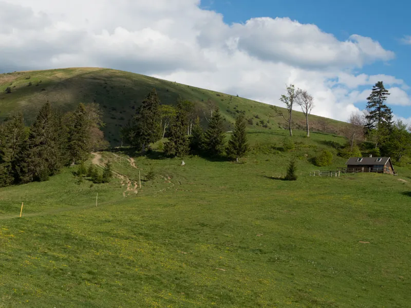
After gaining roughly 100 vertical metres, the climb eases as the path joins a wider forest track. Continue uphill through the woods until you reach a narrow meadow, a former pasture, beginning at around 970 m. Right at the lower end of the meadow, on the left, stands a large tree with the remains of a shepherd’s hut behind it; a little higher up is the Grúň signpost (975 m). A narrow but very long meadow, interrupted here and there by small groups of trees, winds its way almost all the way to the summit of Lysec along the still blue-marked path. As you climb the meadow, you will pass more remains of former shepherd’s huts, and the first views open up towards the ridges of the Malá Fatra and the Turiec Basin with the town of Martin. About 100 vertical metres below the summit, the meadow becomes more wooded and the climb steepens again.
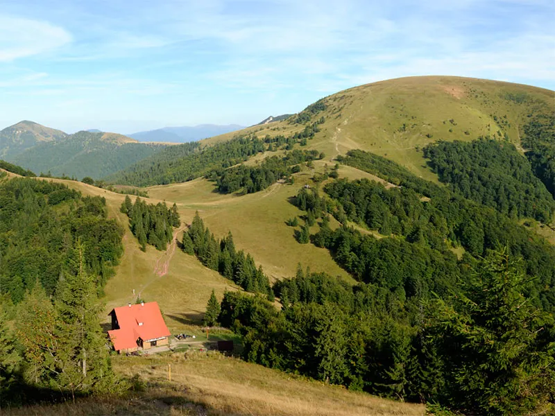
From Lysec there are beautiful views of the Veľká Fatra, especially the peaks of Rakytov, Ploská and Borišov, which look almost within arm’s reach from here. In good weather, you may also see the ridge of the Low Tatras and Veľký Choč farther away.
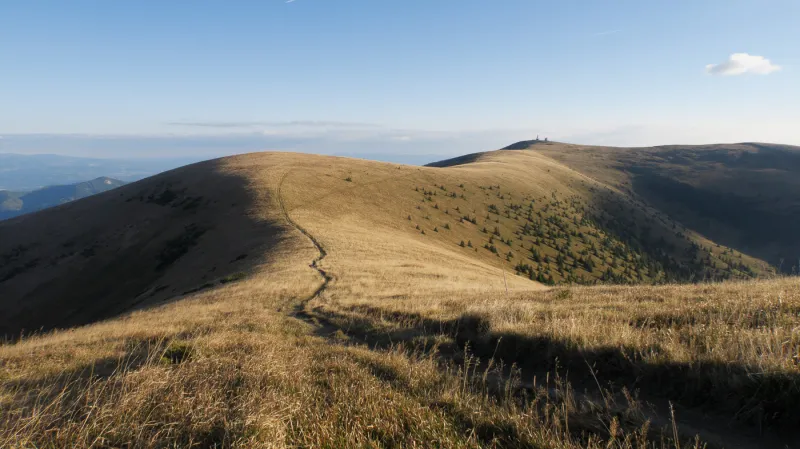
From the summit, begin descending on the yellow trail along the edge of a grassy slope. You will pass a newer shepherd’s hut on your right and continue down to the end of the meadow, where at 1,086 m there is a Polka signpost attached to a spruce tree on the left. Shortly beyond it, the path turns sharply left onto the slopes of smaller meadows. The trail is not marked especially well here, but it is usually clearly trodden, so navigation should not be a problem. Descend about another 100 vertical metres, then the path joins a forest track. Turn right and continue with an easy descent through the forest.
At first the track runs almost straight, then makes a long bend to the right, and shortly afterwards swings sharply right and emerges onto meadows, where it turns right again and briefly leads back into the forest. It then comes out onto another long meadow with several tall spruces. A wide, well-trodden path continues straight across the meadow and brings you to the edge of a small ski slope, where you turn left onto a forest track heading into the woods. After a few minutes, you reach the forest edge at the Medzijarky junction at 740 m.
If you have left your car at the ski area in Jasenská dolina, turn right here onto the green trail, which first crosses meadows and later forest before leading directly back to the parking area. Otherwise, continue on the yellow trail across the meadow on a worn footpath, which soon bends right and takes you past a larger shepherd’s hut to the forest. At the forest edge, join a logging track and follow it down into Belianska dolina. From the valley, the yellow trail leads you back to the village of Belá-Dulice.