Velká Fatra Ridge Traverse
- 3 dny
- 48 km
- 2700 m
A beautiful hike to the broad grassy summit of Ploská, a stop for refreshments at Chata pod Borišovom, and an ascent of Borišov. Wonderful views and a peaceful atmosphere, with the sound of sheep bells drifting from the surrounding slopes.
From the last bus stop, follow the yellow trail back along the road. You will pass Chata Horec, and shortly beyond it, at the junction by the chapel, turn left into the uphill street. If you arrive by car, this is where people usually park. At the bend, continue straight onto the wide farm track, which climbs in several long switchbacks through a beech forest to mountain pastures with views of Ploská, the rocky summit slopes of Čierny kameň, and Rakytov. Before long, you will see two shepherds’ huts on the right side of the track. In summer they are used by shepherds, but outside the main season one of them is usually unlocked and can also be used for an overnight stay.
A little beyond the huts, the route briefly skirts the edge of the forest and soon starts climbing a grassy slope to Ploská Saddle (1,396 m). Just below the saddle there is a shelter with a table and benches, handy if the weather suddenly turns.
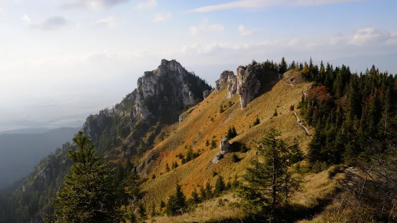
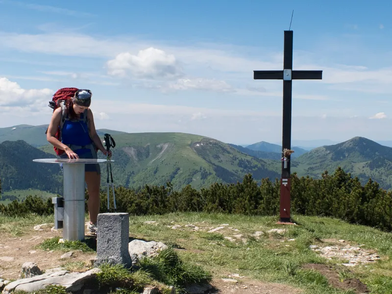
Continue on the yellow trail, which first climbs gently to a point where the green trail branches off to the right and bypasses the summit of Ploská. If you followed it, you would soon come to a spring. The route to Ploská, however, stays on the yellow trail, tackling one short steep section before continuing almost flat to the signpost at the summit. Ploská (1,532 m) is a superb viewpoint — from here you can see Malá Fatra with the distinctive Veľký Rozsutec far to the right, Veľký Choč, the Western Tatras, the Low Tatras, and even the edge of the High Tatras. Among the Veľká Fatra peaks, the most prominent are Rakytov, Čierny kameň, neighboring Borišov, and the ridge with Ostredok and Krížna. If you want to shorten the hike, you can turn left here and descend on the red trail directly to the Chyžky junction.
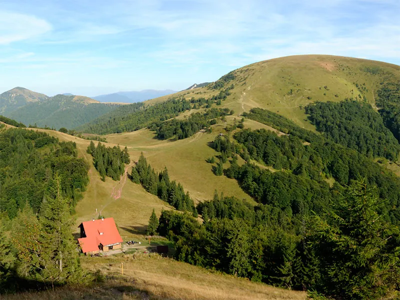
Our hike continues on the red trail as well, but straight ahead, at first on a gentle descent during which more and more of Borišov gradually comes into view, until Chata pod Borišovom appears at its foot. The slope soon steepens, though, and the descent to the nad Studeným (1,318 m) junction can be a bit hard on the knees. From there it is only a short distance to the chata pod Borišovom (1,260 m) signpost. To reach the hut itself, however, you still need to climb a few dozen metres on the yellow trail.
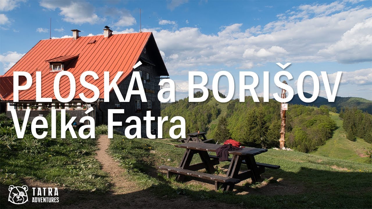
Chata pod Borišovom is a true mountain hut in every sense — supplies are carried in on people’s backs and there is no electricity.
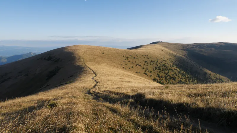
The yellow trail continues in a steep climb to the grassy summit of Borišov (1,510 m). The views from Borišov are similar to those from Ploská, but from here you get a much better look over the Turiec Basin, the town of Martin, and the surrounding villages. Once you have had your fill of the views, descend back to the hut and continue to the nad Studeným junction.
At the junction, turn right onto the blue trail and follow the gently rising path as it traverses the western slopes of Ploská. Along the way you will cross a few streams where you can refill water. The traverse ends on a broad section of the ridge, joining the red-marked route coming from the summit of Ploská and leading to the Chyžky (1,310 m) junction.
Turn left onto the yellow trail and follow the gently descending path to the shepherd’s hut below Kýšky. It is open year-round, and both sleeping inside and camping beside it are allowed. A little below the hut, the trail bends right across a meadow and soon enters the forest.
In the forest, the trail continues its gentle descent at first, but soon becomes steeper, quickly dropping to the bottom of the valley to a shelter. Here an asphalt road begins, leading through Zelená dolina all the way back to Vyšná Revúca (725 m). The yellow waymarks lead you across a few junctions, and before long you will be back at the bus stop or, a little farther on, at your parked car.