Jánošíkove Diery - Grand Circuit
- 05:25
- 12.5 km
- 650 m
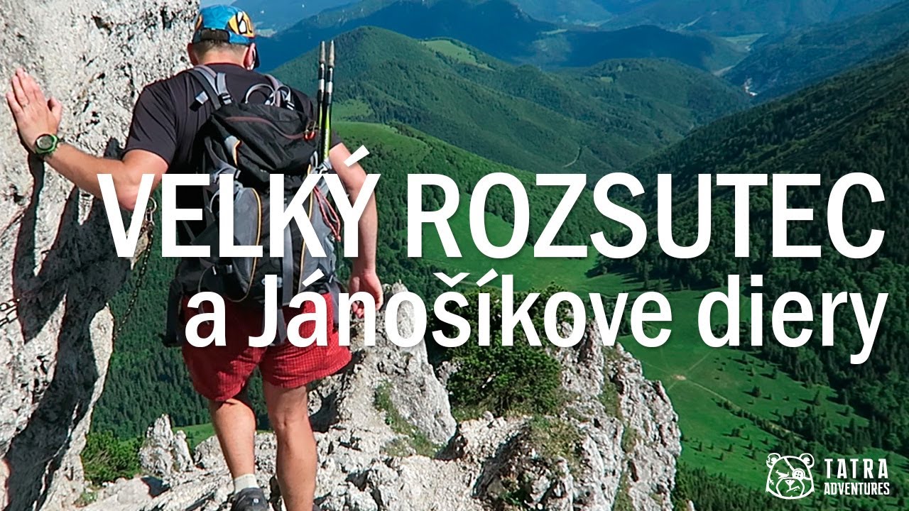
Many people say Veľký Rozsutec is the most beautiful peak in all of Slovakia. That may be a bold claim, but it certainly deserves the title of the finest summit in the Malá Fatra. Add in the spectacular approach through the narrow canyons of Jánošíkove diery, with footbridges and ladders along the way, and you get a stunning hike that would be a real shame to miss.
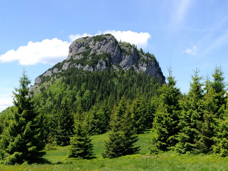
The rocky slopes of Veľký Rozsutec rise directly above Štefanová, making it the dominant feature of the area. From the parking lot at the beginning of Štefanová (625 m), where the bus also stops, follow the yellow trail across the bridge and turn left at the next junction. Continue along the road for about 200 metres, then turn left again at the following junction. After a few dozen metres the asphalt ends, the path leads you out of the village, and the climb begins gradually. After a few minutes, leave the wide track by turning left onto a footpath, which after a short climb through the forest joins a broad field track again. Follow it left, and after 200 metres you will reach the saddle of Vrchpodžiar (745 m).
From the saddle, the yellow trail drops briefly to Koliba Podžiar, where refreshments are available in season. Behind the hut, cross the stream to the Podžiar (715 m) junction, where you turn right onto the blue-marked path, which runs through a meadow for the first few minutes. It then enters the forest and leads into the upper part of Jánošíkove diery, also known as Horné diery.
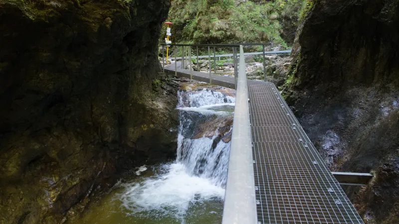
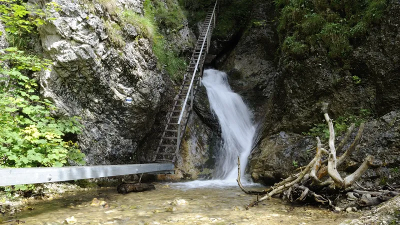
Here the route climbs alongside Hlboký potok, which has carved narrow rock gorges, numerous waterfalls, and striking rock formations. The trail through Jánošíkove diery often runs along footbridges directly above the stream or up ladders beside waterfalls. There are also rocky sections where fixed steel cables help with safe passage.
You continue climbing in this terrain to the pod Pálenicou (900 m) junction, where the valley opens up. Keep going uphill gently on the blue trail to pod Tesnou Rizňou (935 m), where you turn right into a smaller valley and tackle more ladders and cable-protected sections. After about an hour and a half and 250 vertical metres of climbing through Tesná Rizňa, the gradient eases and you emerge from the forest into a meadow with beautiful views of Malý Rozsutec.
In a moment you will pass the Pod Tanečnicou (1,184 m) junction, continue through the forest for a few more minutes, and arrive at a second meadow. Here there is a not very well marked turnoff to a spring, just a few metres left of the trail, reached by a worn footpath. The spring is not very strong, and in late summer and early autumn it is best not to rely on it too much. From the spring it is only a little over 100 metres to the Medzirozsutce saddle (1,200 m).
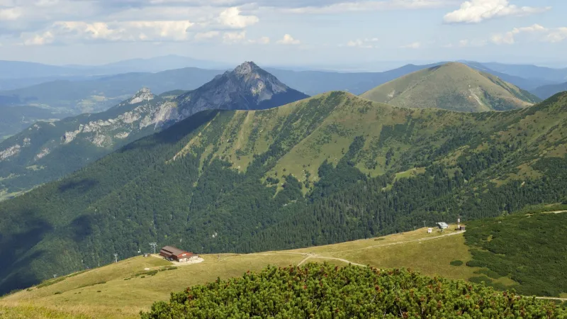
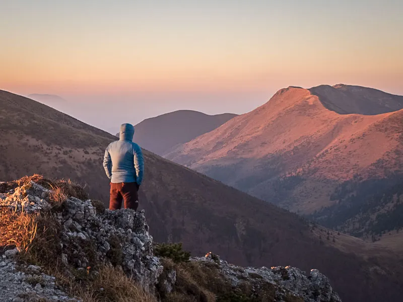
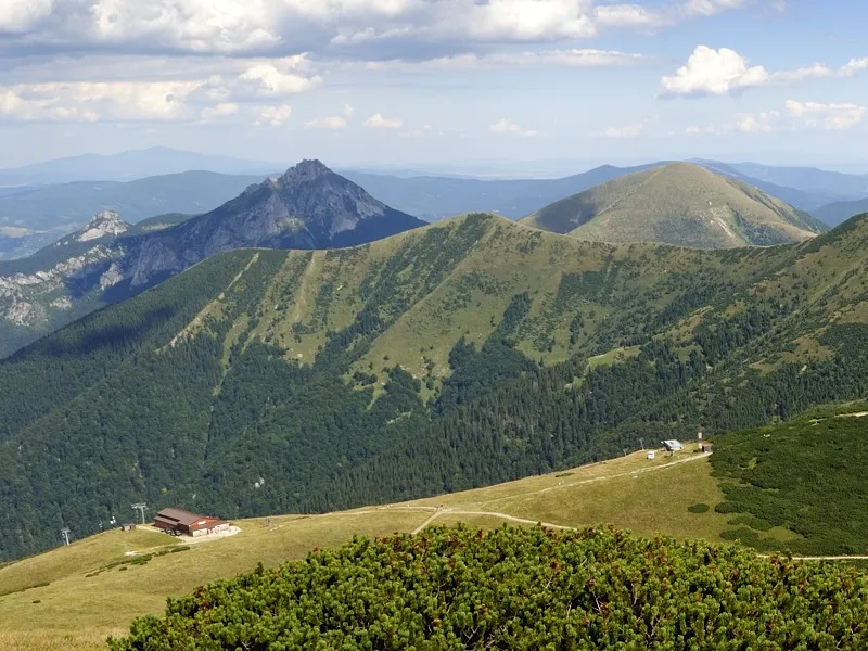
At the saddle, turn right onto the red-marked trail toward the summit of Veľký Rozsutec (1,609 m). From the saddle to the top, you gain more than 400 vertical metres, and the ascent takes about an hour and a half. The route starts in the forest, then continues through dwarf pine, and only just below the summit does it include a few rocky sections, which are not particularly difficult or dangerous. The summit offers magnificent views not only of Malý Rozsutec, Stoh, Osnica, Poludňový Grúň, Veľký Kriváň and Malý Kriváň and other peaks of the Malá Fatra, but also more distant ranges and summits such as Veľký Choč, the Western Tatras, the Veľká Fatra, the Low Tatras, or Babia hora in the Orava region.
The descent to Medziholie saddle (1,185 m) follows the red trail and is especially at the start rocky, steep, and in places exposed. Chains help on the harder sections. If the ladders in Jánošíkove diery did not trouble you, the ascent of Rozsutec and the descent from it should not be a problem either.
A short distance from the signpost at Medziholie saddle, in the direction of Osnica saddle, there is a spring where you can refill water. From the saddle, continue on the green trail, first descending gently with the cliffs of Rozsutec on your right; then the trail drops into a beech forest, where the descent becomes somewhat steeper. After just under two kilometres you pass the Šlahorka (950 m) junction, and after losing more elevation you reach more open woodland with narrow meadows above Štefanová, with occasional views into part of the Vrátna Valley.
At the beginning of the village, you pass the first cottages and join the asphalt road at Chata Pod Lampášom. After 200 metres, turn left at the junction, and moments later you are back at the parking lot where you started.