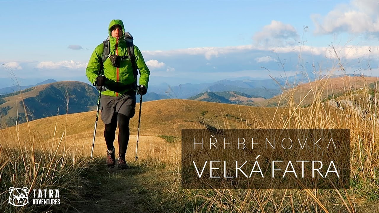
The Great Fatra Double: Tlstá and Ostrá
- 06:25
- 17 km
- 1100 m
The scenic Velká Fatra ridge trail is an unforgettable experience for anyone who loves wandering through wild countryside, deep forests, and grassy ridgelines where herds of sheep and cattle still graze to the sound of bells. You can spend the night in one of the romantic mountain huts and maybe sit by the fire in the evening.
Velká Fatra is a vast mountain range with very few cable cars and mountain resorts. To reach the main ridge, you usually have to first walk many kilometers up long valleys. Thanks to that, there are far fewer people here than in the Tatras or, for example, the Malá Fatra. So anyone with an adventurous spirit will feel right at home here.
Near the summit of Ploská, the main ridge of Velká Fatra splits into the Turiec and Liptov branches, separated by the Lubochnianska Valley, which at 25 kilometers is the longest valley in Slovakia. The Turiec branch is mostly covered in dense forest, is less well marked, and offers fewer views and overnight options, so most hikers choose the Liptov ridge starting in Ružomberok.
From the train station in Ružomberok, first cross the Váh River and climb up to A. Hlinka Square, where the blue trail begins. It leads you out of town first along a long avenue, later through several edge-of-town streets, and then past the Stations of the Cross up to the Kalvária junction (612 m). Here you can turn left for a harder variant and follow the red trail up to the summits of Veľká skala (911 m) and Sidorovo (1,099 m). If you stay on the blue trail, you will soon leave the road for a footpath on the left that traverses the forest below these peaks and, like the red trail, brings you to the Vlkolínske lúky junction (820 m) with a wooden shelter.
Still following the blue trail, continue on the asphalt road until you climb into the Malino Brdo resort (930 m). Here turn left and climb steeply along the edge of the ski slope, gaining more than 250 vertical meters to the top cable car station just below the summit of Malinné (1,209 m). A narrow path then drops a few dozen meters into a beech forest, and after another short rise and descent you turn sharply right. Before long you emerge onto a meadow above the sedlo pod Vtáčnikom junction (1,120 m). If you need water, turn left onto the green trail and after 250 meters you will reach a developed spring.
From the junction, continue right on the green trail and after a short descent followed by a long gradual climb you will arrive at Vyšné Šiprúňske sedlo (1,385 m). There used to be a shepherd's hut on the slopes below the saddle, and overnighting is allowed here. Not far away is Nižné Šiprúňske sedlo (1,327 m), where you turn left. From here you continue mostly through forest on a gently rolling trail to the meadows below Malá Smrekovica (1,485 m), which you bypass on the left. Soon after, you begin descending toward the Smrekovica military recreation center, where you can fill water from a spring on the right side of the trail before the buildings.
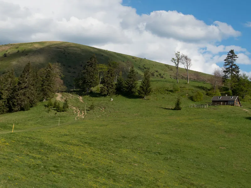
The first building in the Smrekovica complex is the mountain Hotel Granit, whose services you can use if you do not want to sleep outside. If you continue on the green trail, you will walk through forest for a short while and then descend across a broad meadow to the mountain Hotel Smrekovica. Opposite the hotel is a small quarry where camping is permitted.
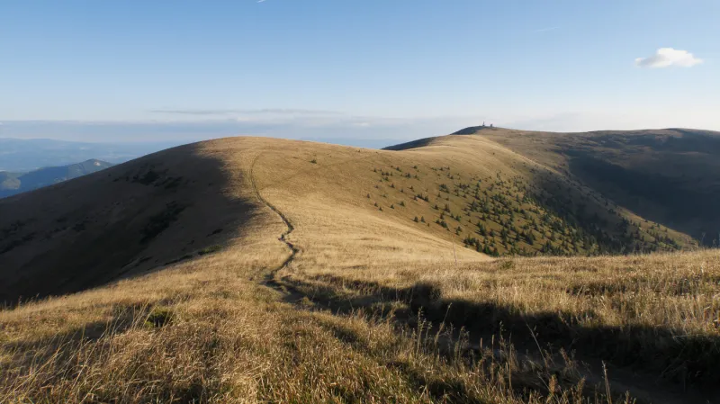
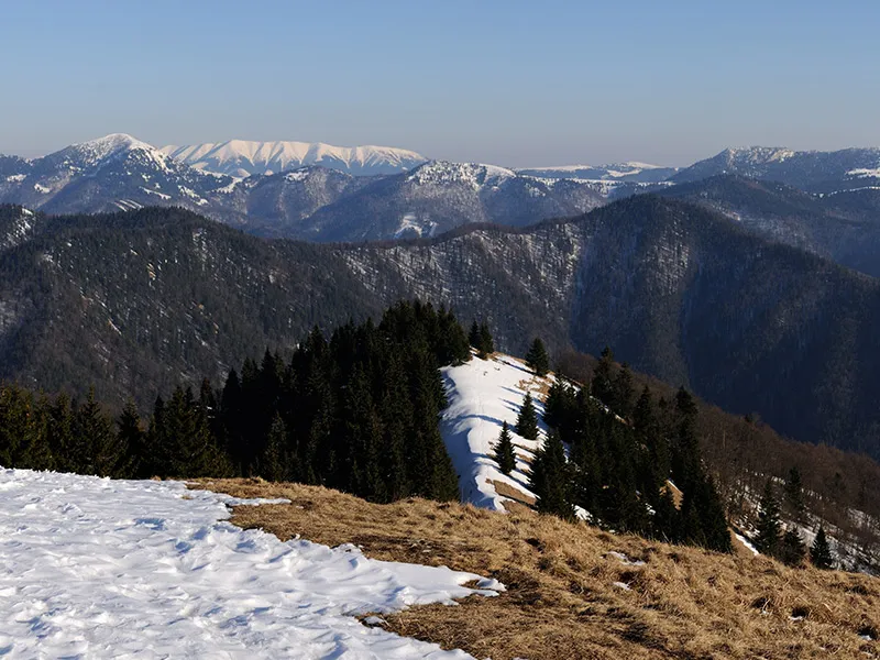
A few dozen meters past the hotel, the trail bends right, and after a short climb through a meadow comes an almost flat stretch running along the grassy southeastern slopes of Skalná Alpa (1,463 m). Over gently undulating terrain, mostly through forest, you reach the northern Rakytov saddle (1,415 m). From here you can either stay on the green trail and climb Rakytov (1,567 m), or bypass it on the yellow trail and avoid the steep ascent. That would be a real shame, though, because this is the first truly panoramic summit on the traverse, with the finest part of Velká Fatra spread out before you, including the rocky peak of Čierny kameň and the massive bulk of Ploská in the foreground.
Continue with a longer descent to the southern Rakytov saddle (1,295 m), then follow an easy trail with one shorter climb and a gentle descent to the sedlo pod Čiernym kameňom saddle (1,266 m). Just beyond the junction a stream begins, where you can refill water. You will not climb the isolated summit of Čierny kameň itself, but instead traverse it comfortably on a path through beech forest. After the forest, on the right side of the trail, you will come to another spring. From here it is only a short distance to sedlo Ploskej (1,390 m), where you leave the green trail and follow the yellow trail with an easy ascent to the summit of Ploská (1,532 m).
It would be a pity not to make a small detour to the fairytale-like Chata pod Borišovom (1,300 m), tucked below the peak of the same name - Borišov (1,510 m) - and reached by the red trail. Like any proper mountain hut, there is no access road, and supplies are carried in on people's backs. At the hut you can eat well, have a drink, and even stay overnight. If you are not in a hurry, you definitely will not regret the steep climb up Borišov itself, where you can enjoy beautiful summit views and a rest in the grass.
From the hut, fortunately, you do not have to climb back up to Ploská, which looks especially massive from here, and can instead take the easy blue-marked traverse. You certainly will not suffer from a lack of views here, and you will also come across several places to refill water.
You rejoin the main ridge trail at the Chyžky junction (1,310 m), from where you can make a short detour to the very basic shepherd's hut known as Salaš pod Kýškami, where overnighting is allowed. If you decide to spend the night here, you will have to make do with a few benches and a small stove for heating, and a spring can be found a little lower down. The hut is just a few minutes away on the yellow trail.
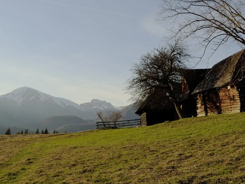
To reach probably the nicest shepherd's hut in the Velká Fatra, where you can also spend the night, you will need to continue for about another three quarters of an hour on the red trail, first on a short steep climb and then more gently. You pass the Koniarky junction (1,377 m), and just before the climb up the wooded slope of Suchý vrch begins, turn right and after a moment you will see it - Salaš pod Suchým vrchom. It is not visible from the marked trail, but several worn footpaths lead to it, so the turnoff should not be hard to find. The hut is equipped with bunk beds, a masonry stove, and there is also space to sleep in the loft. Drinking water is about 250 meters away and is piped into an iron tube.
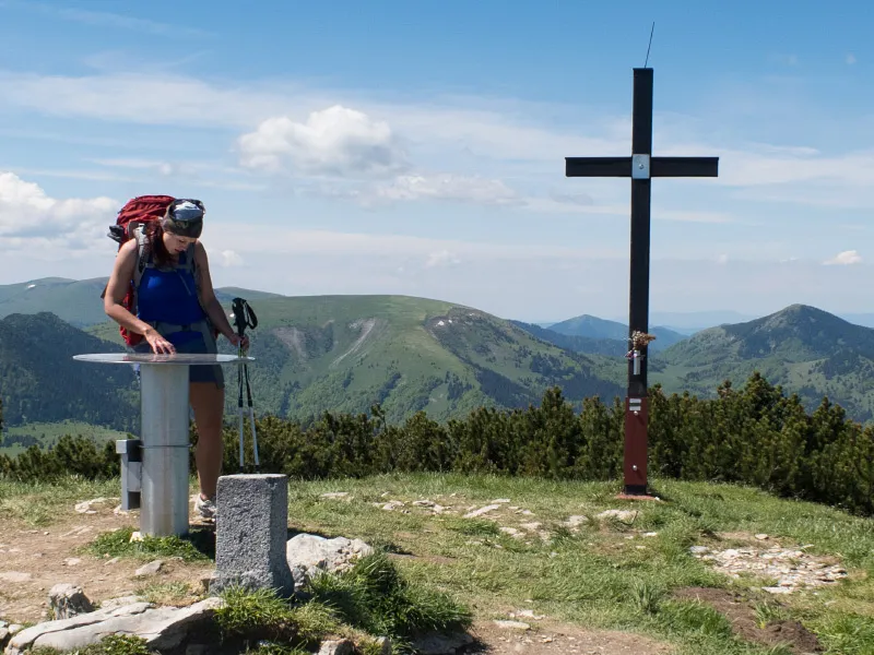
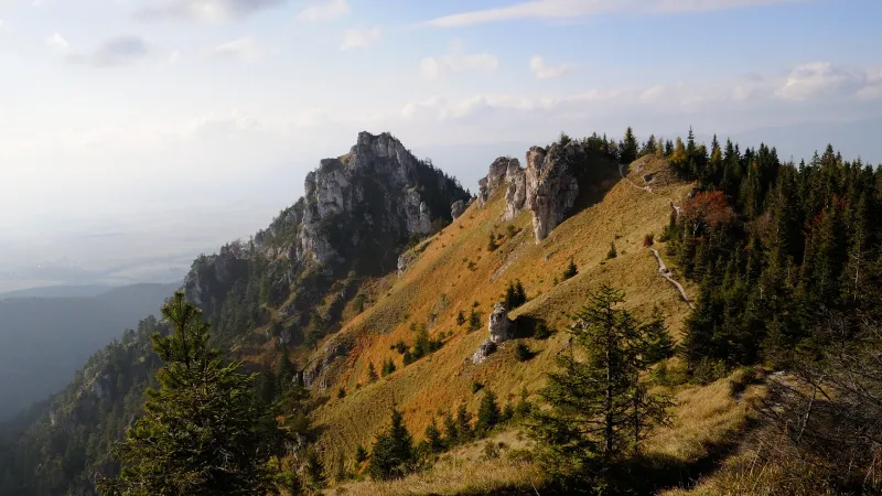
First thing in the morning you will wake up your stiff legs by climbing the slopes of Suchý vrch, although unfortunately the trail does not go over its summit, and continue on to Ostredok, rázcestie (1,592 m). Until a few years ago, it was believed that this was the highest summit of Velká Fatra - Ostredok. Recent measurements, however, showed that the neighboring summit called Pustolovčia is a few meters higher (1,596 m), so they decided to designate that one as Ostredok. Today, therefore, you still have to walk a few hundred meters from here to Ostredok (1,596 m), across the very shallow saddle separating the two tops.
Across gently rolling grassy ridge terrain, you reach the military radar on the summit of Križná (1,574 m). This is effectively the last peak of the Velká Fatra traverse, and the shortest and most practical way back to civilization is to descend from here via the Pod Líškou junction (1,345 m) to the village of Turecká (605 m), and from there walk another 2.5 kilometers to Staré Hory (480 m), which has good bus connections back to Ružomberok.
If you are not in a hurry, you can continue from Krížna along the ridge with a gentle descent into the Králova studňa area (1,330 m), where several more options are available (see Alternatives).
 Kýšky (6:00)