Roháč Lakes: a beautiful loop hike in the Roháče
- 04:45
- 14 km
- 720 m
The ridge traverse of the Western Tatras is one of the finest treks in Slovakia, but also a serious challenge. You can’t hike the whole ridge, because a long section of its eastern part from Pyšné sedlo to the summit of Temniak is closed. And unfortunately that’s not the only problem. There is practically no water on the ridge, and worst of all, nowhere to stay overnight.
The entire mountain range lies within a national park, so you cannot camp wherever it suits you, only in designated places. The problem is that there are none here. That would not be such an issue if there were mountain huts near the ridge, but unfortunately there are none either. Most people solve the Western Tatras traverse by simply taking the risk and sleeping where it makes sense, and some even cross the entire ridge including the closed section.
If you want to follow the rules and avoid trouble with park rangers, you will have to stick to the accessible part and, on two evenings, make a rather illogical descent of more than 600 vertical metres, only to climb back up to the same spot the next morning. That is, unless you want to skip part of the ridge... This makes the Western Tatras ridge traverse a trip only for hikers in excellent shape. Let’s take a look at how to do it.
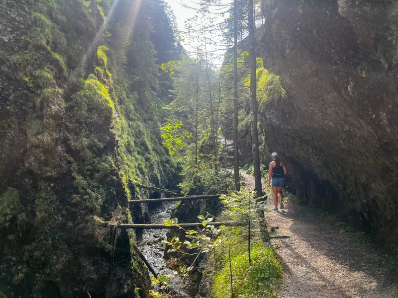
From the junction by the bridge on the edge of the village of Jalovec, follow the yellow trail along the asphalt road. After two and a half kilometres, at the Bobrovecká Vápenica junction, turn left onto the blue trail. It begins with a gentle climb, with a meadow on your right and scattered cottages on your left. Soon, however, it steepens sharply through the forest and, via the junctions nad kameňolomom (1,035 m) and pod Babkami (1,220 m), brings you to Chata Pod Náružím (1,420 m) (www.chatacervenec.sk), sometimes also called Červenec. The hut is usually open only on weekends, but operates daily in July and August. Accommodation must be booked in advance with the hut keeper (contact).
If you still have enough time and energy after checking in, you can make a light two-hour side trip to the summit of Babky (1,566 m).
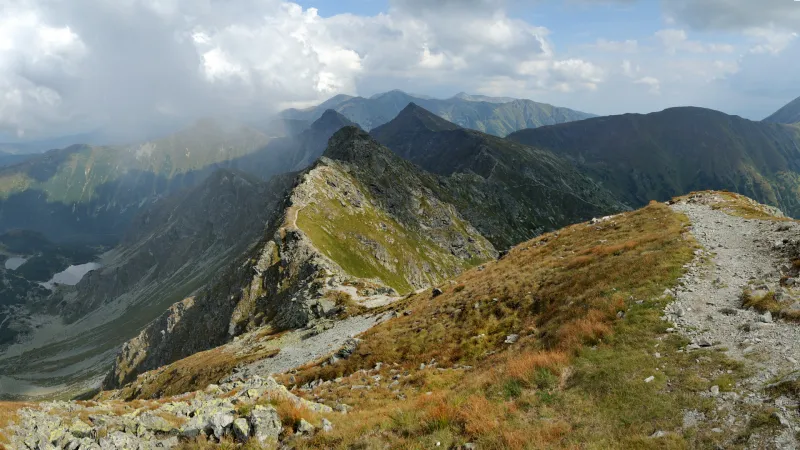
From Chata Pod Náružím, climb on the blue trail to Predúvratie saddle (1,585 m), turn right onto the green trail, and continue up to Ostrá (1,764 m), followed by a short descent to Priehyba saddle (1,650 m), and finally the climb to Sivý vrch (1,805 m). From Sivý vrch, a steep descent awaits, secured with chains in several places. This is followed by an easier stretch, leading mostly through dense dwarf pine, to Pálenica saddle (1,570 m). A short way from here, along the yellow trail toward Bobrovecká dolina, you can refill water from a spring feeding the stream.
From the saddle continue on the red trail, first more steeply and later more gently, on a long climb above the dwarf pine belt and across the summits of Pálenica (1,753 m) and Zuberec (1,806 m) to Brestová (1,903 m). Here you briefly lose a few metres of elevation on the descent to Parichvost saddle (1,856 m), before gaining them back on the climb to the first two-thousander, Salatín (2,048 m).
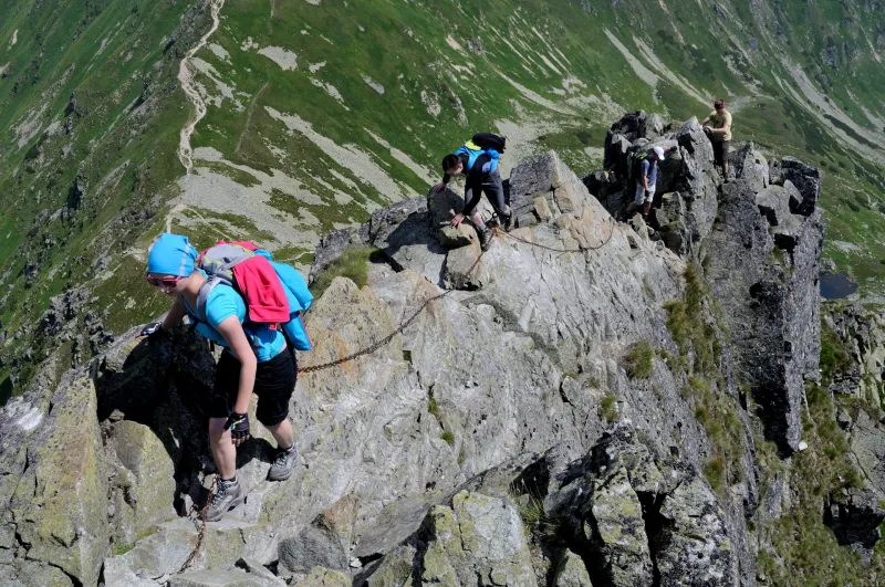
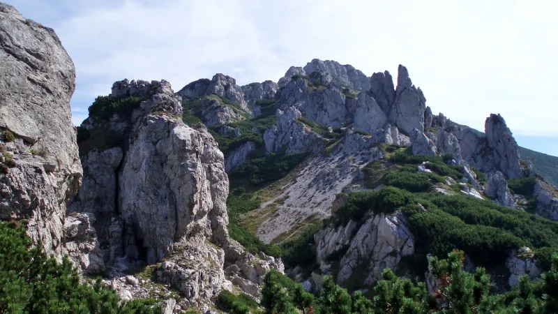
Beyond Salatín you will reach a beautiful rocky ridge section called Skriniarky, a welcome change from the worn footpaths so far. Here you will need to use your hands from time to time, and you will encounter several chains as well. Skriniarky are a kind of taster of the more difficult sections that await you on the Western Tatras traverse.
After crossing Skriniarky, you will stand on the summit of Spálená (2,083 m) and continue to neighbouring Pachoľa (2,167 m). Beyond it, descend to Baníkovské sedlo (2,040 m) and begin climbing the well-known Baníkov (2,178 m). Baníkov is famous for its difficult chain-secured sections, among the toughest spots of the entire traverse. The first of these challenging passages comes right after the summit in the form of a fairly steep rocky ridge. Once you get over it, more chains and difficult stretches follow on the descent.
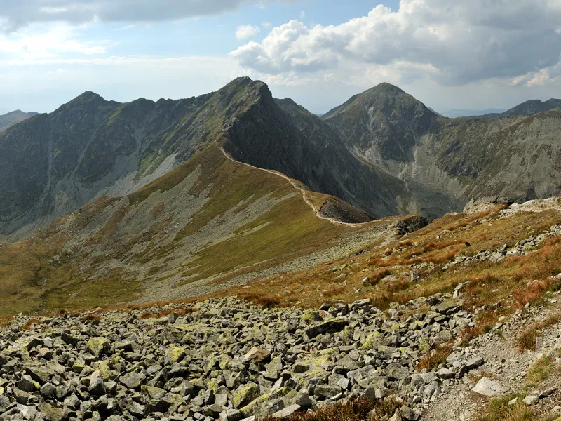
After Baníkov, you get a short break from the technical terrain with an easy climb on a worn path to Hrubá kopa (2,166 m). Then more demanding, and at times quite long, rocky sections fitted with chains await again, where you will climb, descend, and traverse. By now you will be crossing Tri kopy (2,136 m), the last summit of the day. This is followed by a long, steep descent with lots of loose stones to Smutné sedlo (1,965 m).
From Smutné sedlo, descend on the blue trail about 650 vertical metres to Žiarska chata (www.ziarskachata.com). Overnight accommodation needs to be booked well in advance.
In the morning, you first have to return to Smutné sedlo. Continue on the red trail along the ridge, climbing to Plačlivé (2,125 m), then immediately descending to the saddle that separates it from Ostrý Roháč (2,088 m). Ostrý Roháč is another icon of the Western Tatras traverse and also the last place on the route where you will deal with chains. You meet the first ones already on the ascent, but the hardest spot comes right after the summit in the form of a very narrow rocky ridge with steep drops on both sides. Once you get past this section, the descent to Jamnícke sedlo (1,908 m) should no longer cause any trouble.
From the saddle, you need to climb about 150 vertical metres to Volovec (2,063 m), the first summit on the Slovak-Polish border. This is followed by a descent to the saddle pod Deravou (1,836 m), a traverse below the summit of Deravá (1,955 m), and a short descent followed by a short climb to the junction on the slopes of Hrubý vrch.
From the junction, descend on the green trail via the pod Hrubým vrchom junction (1,480 m) to the pod Smrekom junction (1,305 m). Then continue down the valley on the blue trail for about another kilometre until Koliba pod Pustým, the destination of today’s stage, appears on your right. There is a spring just beyond the hut.
UPDATE: Although this does not follow directly from any valid law or other regulation governing movement within TANAP National Park, the TANAP administration informed us in response to our inquiry that it considers staying overnight in the hut to be bivouacking, because the hut is not registered in the land cadastre. Bivouacking is prohibited within the national park.
If you want to avoid possible trouble, instead of sleeping at the hut you will need to continue on to the campsite at the mouth of Račková dolina (i.e. about 6 km farther).
First thing in the morning, you will warm up your legs with a climb of more than 600 vertical metres back to the ridge, followed by a steep ascent to the Hrubý vrch junction (2,090 m), which is not on the actual summit but a little below it. If you want to visit the summit of Hrubý vrch (2,137 m), you will need to make a short detour on the green trail.
Next comes a descent to the broad saddle Jarabcza przelecz and a short gentle climb to the summit of Končistá (1,993 m). A little beyond the top lies Račkovo sedlo (1,958 m), from where you can descend about 150 vertical metres on the yellow trail to refill water at a spring. Beyond the saddle, a long climb leads to Klin (2,173 m), followed immediately by a long descent to Gáborovo sedlo (1,938 m). After that, you get a rest on a comfortable path running just below the ridge to Bystré sedlo (1,946 m).
Beyond Bystré sedlo comes the final climb of the Western Tatras traverse, and it leads straight to their highest summit. Bystrá (2,248 m) does not lie on the red-marked trail, so you will need to take a detour and climb 300 vertical metres on the blue trail. The magnificent views of the High Tatras are definitely worth it! From Bystrá, you can descend by the shortest route (unmarked) back to the red trail, rejoining it on the indistinct summit of Blyšť (2,155 m), and then descend to Pyšné sedlo (1,792 m).
At Pyšné sedlo, the ridge traverse essentially ends, because the long ridge section from here to Temniak is closed. That leaves no choice but to descend on the blue trail through Kamenistá dolina to Podbanské, where the Western Tatras ridge traverse comes to an end.