Roháč Lakes: a beautiful loop hike in the Roháče
- 04:45
- 14 km
- 720 m
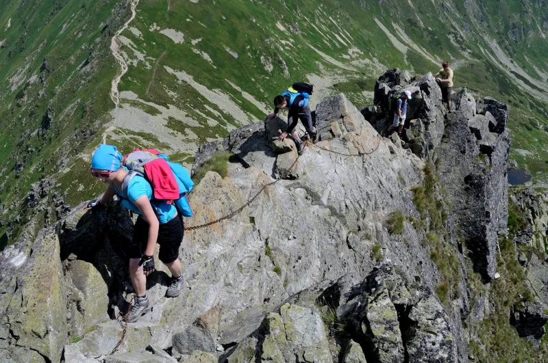
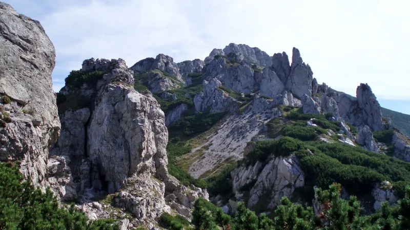
One of the finest and most demanding hikes in the Western Tatras—and in all of Slovakia—leads across Tri kopy and Baníkov. Expect narrow, exposed rocky ridges and scrambling over steep sections while holding onto iron chains fixed to the rock. In short, a dream route for experienced mountain hikers and a nightmare for anyone with a fear of heights.
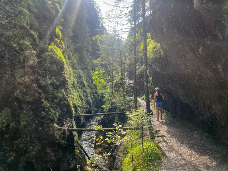
From the bus stop on the bend, follow the red trail onto the side asphalt road. After a few minutes you will pass the Šindlovec guesthouse, and after several bends you will reach Šindlovec junction—a former parking area with a snack stand. If you arrived by car, you can get here from the parking lot on the green trail. Continue uphill on the asphalt road, which occasionally opens up views of the main ridge with the peaks of Tri kopy, Hrubá kopa, Baníkov and Spálená. Pass through the Adamcuľa junction (1,189 m), still following the red trail, until you reach the snack stand at the former Ťatliakova chata junction (1,350 m), where you can buy refreshments and rest on the benches. Behind the stand lies the man-made Ťatliakovo lake, with beautiful views of the twin summit of Ostrý Roháč and Plačlivé.
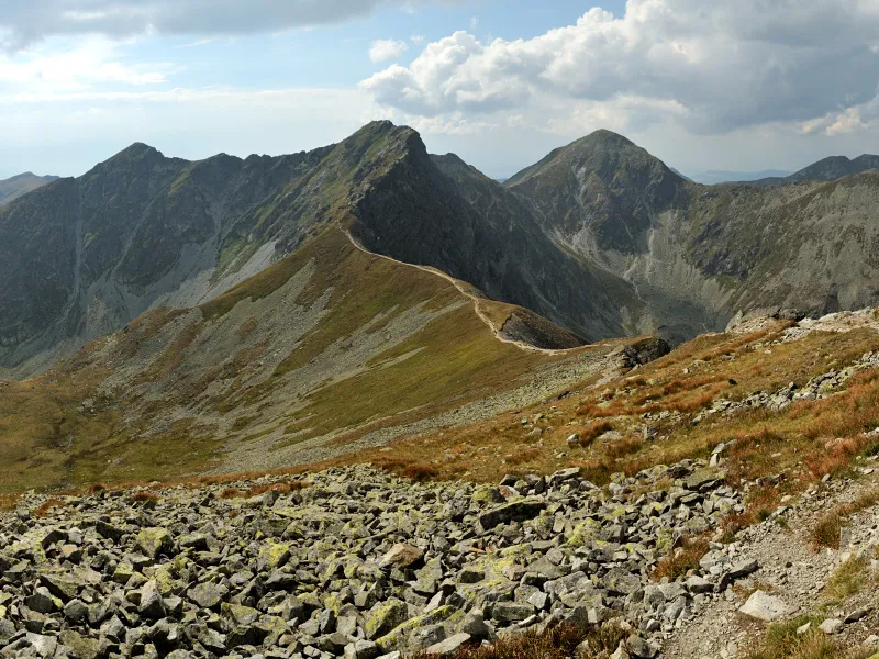
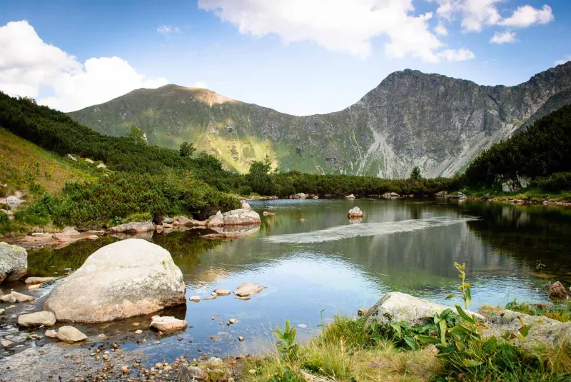
Continue on the blue-marked path, which climbs gently through Smutná Valley. About ten minutes from the hut, you will come to a strong spring where you can refill your water. After another twenty minutes you will pass the Smutná dolina junction (1,522 m). Keep climbing nearly 450 vertical meters on the blue trail, which becomes a bit steeper near the head of the valley and forms several switchbacks leading up to Smutné sedlo (1,962 m).
From here all the way to Baníkov, you will be moving through exposed rocky terrain with a real risk of falling, and you will often need to use your hands to get through. This ridge section is among the most demanding in the entire Western Tatras. If you do not have experience in high-mountain terrain, choose an easier hike instead.
This is followed by a short descent into a broad saddle, after which begins a fairly technical climb to Baníkov (2,178 m). The ascent often follows a narrow and exposed rocky ridge, with chains in places. Some rock outcrops can be bypassed on a worn path a few meters lower down, but many of the difficult sections cannot be avoided. The demanding ascent ends only at the summit of Baníkov itself, followed by a much easier descent to Baníkovské sedlo (2,040 m).
At the saddle, turn right and follow the yellow trail steeply down in switchbacks into Spálená Valley. The descent gradually eases and the first patches of dwarf pine appear. About two kilometers from the saddle, you will pass the Pod Hrubou kopou junction (1,577 m) and continue descending through dwarf pine on the yellow trail for roughly another 100 vertical meters to the pod Predným zeleným junction (1,473 m), where tired hikers can rest at one of several tables with benches.
Beyond the junction, the path enters the forest and after twenty minutes of descending brings you to a wooden footbridge over a stream. A short spur trail across it leads to Roháčský Waterfall (1,340 m). The waterfall is literally just around the corner and is well worth the detour. Below the waterfall there is only a short steeper descent; then the path widens and the slope becomes gentler. Cross the stream on a wooden bridge and in a few moments you will reach the asphalt road, which after several bends joins the main road of Roháčska Valley at the Adamcuľa junction. From here, return to the bus stop or your car along the same route.