Roháč Lakes: a beautiful loop hike in the Roháče
- 04:45
- 14 km
- 720 m
The toughest section of the Roháče ridge, and arguably of the entire Western Tatras, leads over the notorious chain-secured section on Baníkov, the easier Hrubá kopa, and then more chains on the way to Tri kopy. If you enjoy chains and exposed rocky terrain, you’ll love this route.
From the parking area at the mouth of Žiarska dolina, follow the blue trail along the paved road deeper into the valley. Soon you will pass Medvedia adit, an old mining tunnel more than 500 metres deep that is open to the public. About half a kilometre farther on, the blue trail leaves the road to the left, crosses the stream and continues on a gently ascending forest path. After roughly three kilometres, on a wide deforested area (the result of a huge avalanche from 2009), you rejoin the paved road, which brings you in about 15 minutes to Žiarska Hut, where you can get a drink, a good meal, or stay overnight.
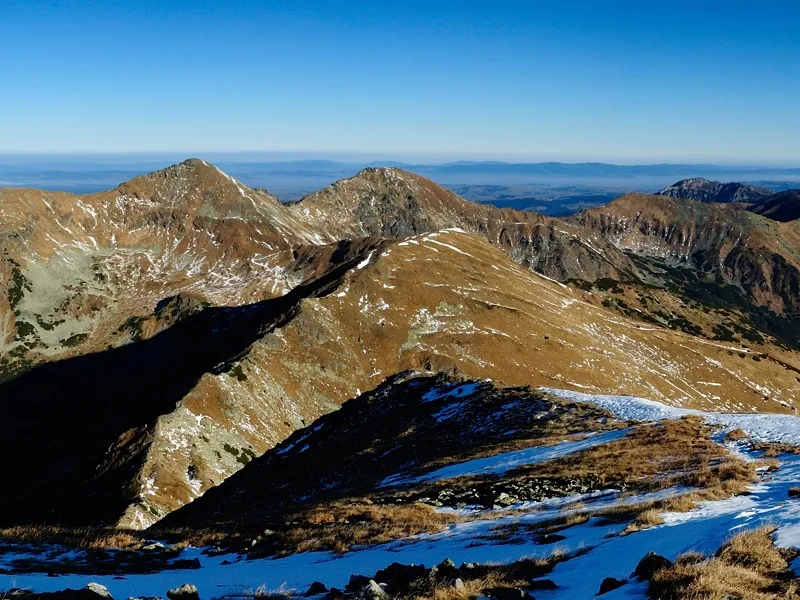
Continue past Žiarska Hut and the mountain rescue hut, behind which you will find a signpost. Here, turn left onto the green trail, which passes the symbolic cemetery, a memorial to victims of the Western Tatras. The path climbs gradually past Šarafiový Waterfall, which is most impressive after rain when it carries more water. Before long, the gradient steepens and you begin a long, demanding ascent through dwarf pine, with massive Baranec behind you. As you gain height, the dwarf pine thins out and is eventually replaced by grassy slopes. That means you have reached Jalovecké sedlo (1,858 m), where you can enjoy views that had been hidden until now: Veľký Choč, Malá Fatra, Sivý vrch, Pachoľa, and the summit of Baníkov peeking out from behind Príslop.
Now comes Príslop (2,142 m), whose rocky summit requires another 300 metres of ascent. The reward is an unobstructed panorama of Baníkov and its summit ridge, as well as Hrubá kopa, Tri kopy, Plačlivé, Ostrý Roháč, Bystrá, and many other peaks, with the High Tatras visible in the background.
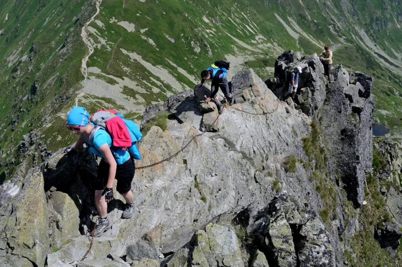
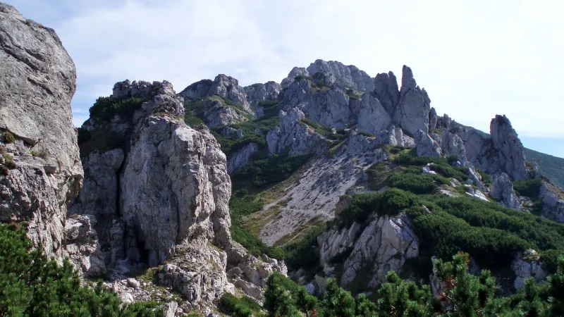
Beyond Príslop, the terrain becomes more demanding. A short descent along a rocky ridge loses a few dozen metres, only for you to climb them again straight away on the way to Baníkov (2,178 m). From this side, the ascent to Baníkov is not especially difficult; the hardest part is still to come. From the summit, continue right on the red trail along a narrow, rocky ridge with steep drops on both sides. In this section, Baníkov is fitted with several chains, which are especially useful in poor weather and on a few steep descents. Once you have overcome all the obstacles Baníkov throws at you, you emerge in a broad grassy saddle, from where a stony path leads up to the summit of Hrubá kopa (2,166 m).
Below Hrubá kopa, steeper rocky terrain begins again. You will face several more difficult chain-secured sections on the climb to Tri kopy (2,136 m). In particular, the short ascent up a steep “chimney” and the traverse across a steep rock slab can trouble some hikers. If Baníkov did not give you any problems, the climb to Tri kopy should be manageable as well.
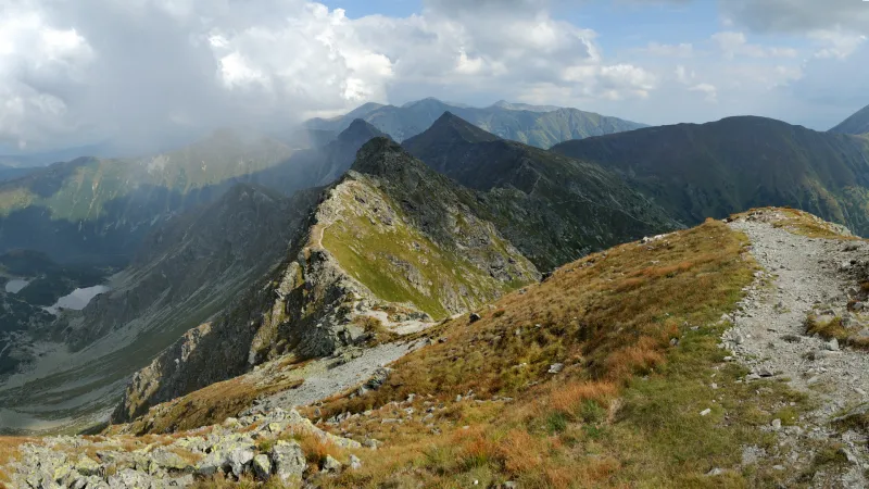
All that remains is a steep, rocky descent to Smutné sedlo (1,965 m), where the demanding terrain finally ends. The descent from the saddle back to Žiarska Hut follows the blue trail along the right-hand side of the ridge running south from the main crest. Before long, you cross to the left side of the ridge and descend from it to the junction Pod Homolkou (1,665 m). From there, still following the blue trail, it takes about 45 minutes to get back to Žiarska Hut.
You already know the route from the hut, and if you do not feel like walking all the way back to the parking area, you can rent a scooter here in season (details) and ride down from Žiarska Hut.