Loading…

Bystrá – hike to the highest peak in the Western Tatras

Difficult physically demanding Easy technical
07:20
Walking time
19 km
Distance
1400 m
Elevation gain
Loop
Difficult physically demanding Easy technical

Hike description

Bystrá is the highest peak in the Western Tatras, with magnificent views, yet because of its remote location it remains one of the less-visited summits. With a bit of luck, you may spot marmots near the head of Bystrá Valley and chamois along the ridge.


Ascent of Bystrá

From the Hrdovo trailhead (850 m), follow the yellow trail along a forest track lined with scattered cabins on both sides. With a gentle climb, you gain just over 100 vertical meters to the pod Bystrou junction (978 m), where you continue on a forest path that leads out to a clearing with an intersection of logging tracks. Keep right and continue uphill on the track, first through the forest and later across a large deforested area where the woods were damaged by a windstorm.

About half a kilometer from the clearing, the track turns left into Bystrá Valley and gradually becomes a forest path, climbing gently through beautiful wild woodland thick with moss and ferns along the way. Just under 2.5 kilometers from the start of the valley, you pass a half-collapsed shelter next to what used to be a maintained spring. Today, like the shelter itself, it is no longer very usable.

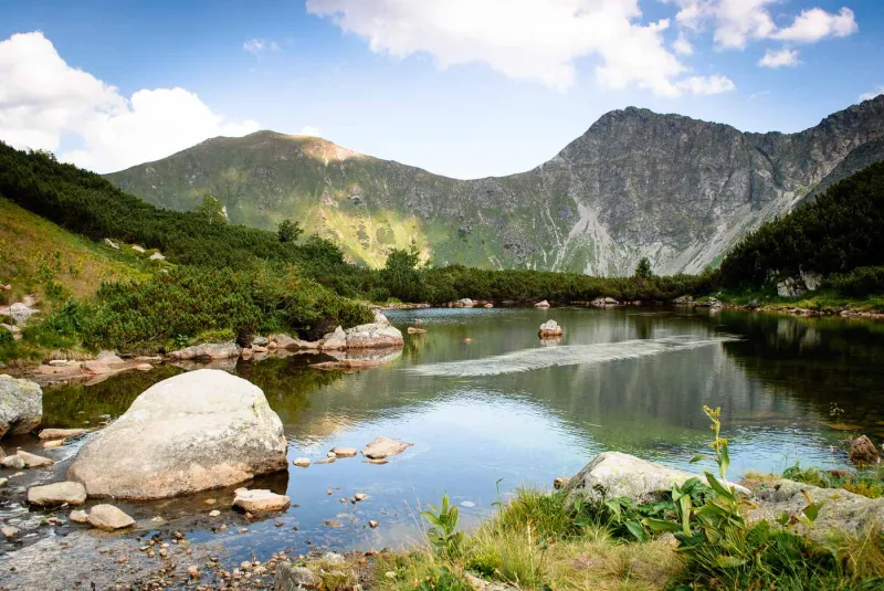
Near the shelter, the forest gradually gives way to dense dwarf pine, through which a good footpath leads safely, climbing gently beside the stream. Two kilometers beyond the shelter, you reach the broad alpine meadows in the upper part of Bystrá Valley and pass a small tarn that is often dry by late summer. Here the trail begins to curve toward the steep slope on the right, where a steep ascent in switchbacks leads up to the saddle on the ridge. Already on the way up, views open toward the Bystrá Lakes at the head of the valley, and from the saddle you will also see peaks to the east that had previously been hidden.

View from Bystrá

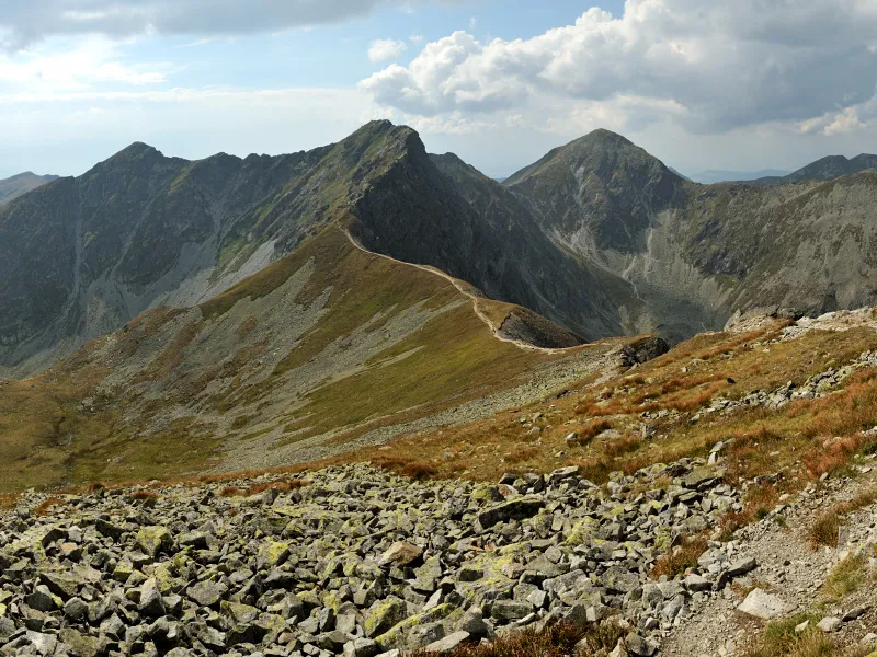
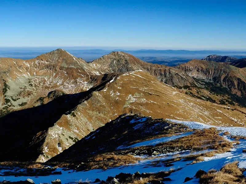
From the saddle, turn left and continue up the grassy ridge for about another 250 vertical meters to the summit of Bystrá (2,248 m). The top offers superb views of the opposite peaks of Klin and Jakubiná to the west and Veľká Kamenistá to the east, separated from Bystrá by Pyšné Saddle far below. In good weather you can also see many more distant peaks not only in the Western Tatras and the High Tatras, with unmistakable Kriváň all the way to the right, but also the ridges of the Low Tatras and the Veľká Fatra.

The shortest descent is to return the same way back to Hrdovo.

Useful info

Take the train to Liptovský Mikuláš. The bus station is right next to the railway station, and several times a day buses run from here via Pribylina to the Hrdovo stop.

Search connections

By car, drive to Liptovský Hrádok and turn toward Pribylina. If you are using the motorway, take exit no. 284. Beyond Pribylina, the road first runs through meadows and later enters the forest. After about 1–1.5 kilometers in the forest, look for a small parking area on the left with a shelter and several information boards.

Hrdovo zluta pod Bystrou junction (0:35) zluta Bystrá (4:20) -> and back (7:20 total)

None; water only from the upper part of the stream.

  • Descent via Račkova Valley. From the summit, descend on the blue trail to Bystré Saddle (0:40), then continue on blue through Gábor Valley to the pod Klinom junction (1:40). Near the junction stands Koliba pod Klinom, one of the few places in the Western Tatras where you can stay overnight close to the ridge without violating TANAP visitor regulations. Continue on the yellow trail through Račkova Valley to the Nižná lúka junction (3:40), then on blue to Úzka dolina, ústie (4:10). From there, continue left on the red-marked Tatra Magistrale to the pod Bystrou junction (5:40), then right on yellow down to Hrdovo (6:10). If you do not need to return to your car in Hrdovo, descend from the Úzka dolina, ústie junction on the green trail along the asphalt road to the Pribylina, skanzen junction (0:50). Nearby you will find a bus stop (“Pribylina,,Rač.dol.ráz.h.Esperanto”). You can also continue all the way to Pribylina (1:10), where buses run more frequently.
  • Descent via Kamenistá Valley. From Bystrá, descend on an unmarked path for just under 100 vertical meters to the indistinct summit of Blyšť (0:25), where you join the red trail and descend to Pyšné Saddle (1:10). At the saddle, turn right onto the blue-marked path and descend through Kamenistá Valley all the way to Podbanské (3:40). From there, you can return by bus (stop “Pribylina,,Zruby”), walk back to Hrdovo along the road, or take the longer route on the red-marked Tatra Magistrale to the pod Bystrou junction (4:50), from where you descend to Hrdovo (5:20) on the yellow trail.

Hikes in the Western Tatras and Roháče

Show all
Back to top