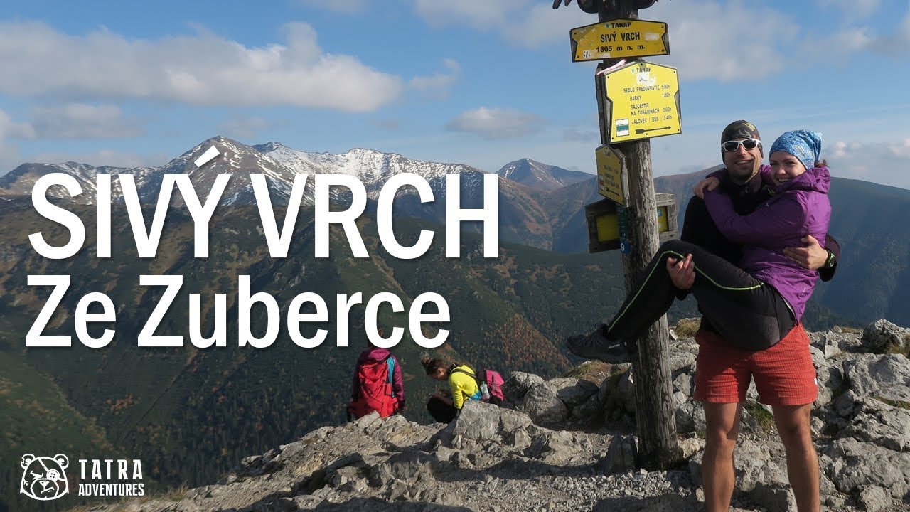
Roháč Lakes: a beautiful loop hike in the Roháče
- 04:45
- 14 km
- 720 m
Sivý vrch is not one of the highest peaks, but the ascent through the Radové skaly rock city, where you’ll occasionally use your hands, has an unforgettable charm.
From the bus stop, follow the road toward Zuberec until you reach the Biela Skala ranger station on the left side of the road, just beyond a long right-hand bend. Opposite it, at the edge of the forest, there is a shelter with information boards and a hiking signpost. From there, head into the woods on the red trail along a wide forest track that climbs gently at first.
The red trail leads you through several forest-road junctions and soon starts climbing steeply through the woods, across a large windthrow area and back into the forest, eventually bringing you below the first rocky outcrops – the summit of Biela skala (1,316 m).
After a few metres, you will come across an unmarked but well-trodden footpath that lets you make a short detour to the summit cross. The views from there are much better than from the trail itself, not only over the nearby area but also toward the Veľká Fatra and Malá Fatra.
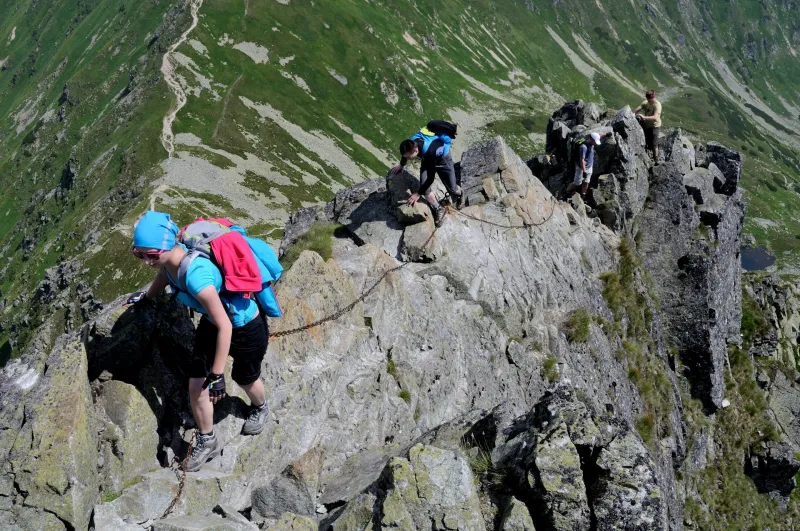
As you continue uphill on the red-marked path, the forest gradually thins out and gives way to dwarf pine and rock formations. The trail winds gently among them until you find yourself in a true rock city known as Radové skaly. Here you will come across a few spots where you may need to use your hands. At two places near the summit, the rock is fitted with a chain, which is not really necessary for the ascent but can be useful on the way down or in wet weather. There is no need to worry about dangerous or highly exposed sections – you won’t find any on the route to Sivý vrch.
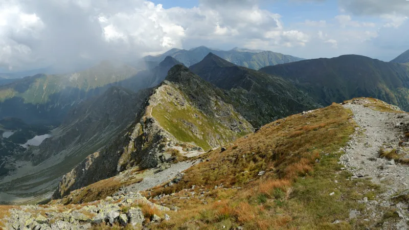
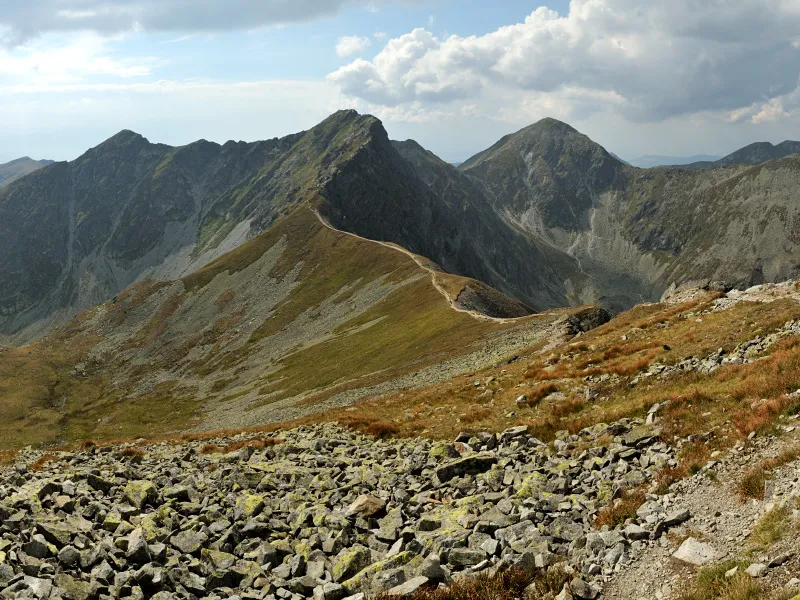
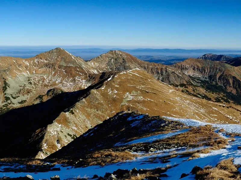
Sivý vrch rewards the climb with views of several other peaks in the Western Tatras, such as Ostrá, Osobitá, Salatín, Spálená, Pachola, Baníkov and Baranec. In other directions, you can also see the more distant Veľký Choč, Babia hora, Pilsko, and other mountain ranges – Veľká Fatra, Malá Fatra and the Low Tatras.
The shortest descent follows the same route back.