Roháč Lakes: a beautiful loop hike in the Roháče
- 04:45
- 14 km
- 720 m
This demanding full-day hike to Baranec and Plačlivé has no technical difficulties, and your effort is richly rewarded with views of most of the Western Tatras, and even some High Tatras peaks led by unmistakable Kriváň.
At the end of the parking area in Žiarska dolina, from the Žiarska dolina, ústie junction, turn right onto the asphalt road and follow the yellow trail markers, which will lead you to Baranec and then on to Plačlivé. After the first bend, the trail turns left onto a footpath and continues alternately through forest and logged clearings. Before long you will cross a forest track, and from there the route climbs steadily through the woods for about 400 vertical metres. Here the forest gradually gives way to dwarf pine, and soon you will reach the Holý vrch (1,682 m) junction, where you can rest on benches and enjoy views over the Liptov Basin and the ridge of the Low Tatras.
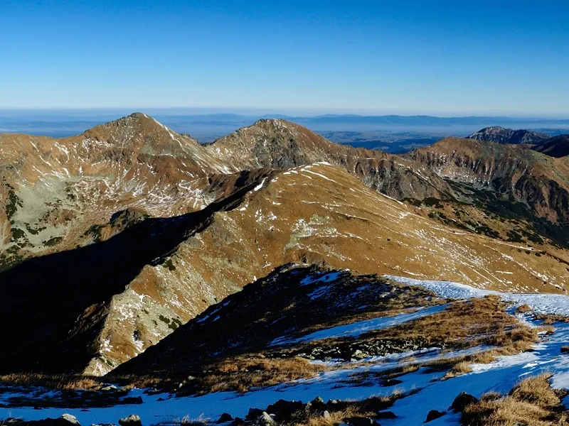
To reach the actual summit of Holý vrch (1,723 m), you still need to climb a little farther through dwarf pine, which continues all the way to an inconspicuous unnamed top at 1,881 metres, marked only by a wooden post. This is a fantastic viewpoint, with fine views of part of the main ridge and the peaks of Baníkov, Hrubá kopa and Tri kopy. From here you also get a great view of Baranec itself, which looks deceptively close. In reality, you still need to gain another 300 vertical metres up its grassy southern ridge.
When you finally reach the concrete pillar on the summit, a magnificent panorama opens up of the previously hidden peaks of Plačlivé and Ostrý Roháč to the north, and Hrubý vrch, Jakubiná and Bystrá — the highest peak of the Western Tatras — to the northeast. To the east, the peaks of the High Tatras appear, with unmistakable Kriváň. Turn around and you will see the Liptovská Mara reservoir, the summit of Veľký Choč, and in good visibility even the ridge of the Malá Fatra range.
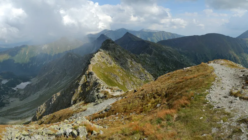
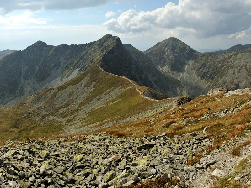
From Baranec, continue on the yellow trail with a steep descent of about 200 vertical metres. Take care here, as the rocky path can be quite slippery. This is followed by a pleasant, gently undulating walk along a grassy ridge with only occasional rocky sections, crossing the Smrek summit (2,072 m) with beautiful views of the surrounding peaks. From Smrek, descend very gradually to Žiarske sedlo (1,919 m). From the saddle, a steep climb of about 150 vertical metres on a rocky path leads to the Plačlivo, rázcestie junction, and from there it is only a short distance on the red trail to Plačlivé (2,125 m).
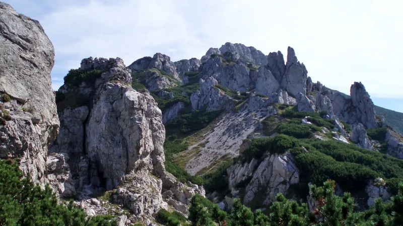
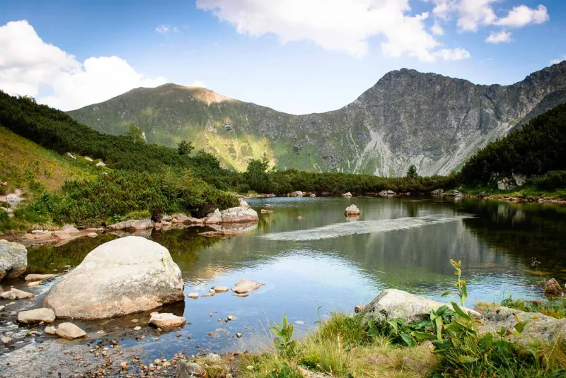
From the rocky summit of Plačlivé, the view opens into the deep Roháčska dolina, with three of the four Roháčske plesá visible below. Ostrý Roháč and Volovec are right in front of you, and the westward view toward Smutné sedlo, with Tri kopy, Hrubá kopa and Baníkov rising above it, is unforgettable and very photogenic. Looking back the way you came, you will of course see the massive bulk of Baranec, with its long slopes dropping away on the right into Žiarska dolina.
From Plačlivé, descend back to Žiarske sedlo and this time follow the green trail down grassy slopes, past the shallow Žiarske pleso and across a boulder field to the Pod Homolkou junction (1,665 m), then continue on the green-marked path to Žiarska chata (1,283 m), where you can eat, drink, and also stay overnight.
The final six kilometres and 400 metres of descent back to the parking area can be comfortably covered on a kick scooter, which can be rented at Žiarska chata during the summer season (details).
If you prefer to walk, continue down the asphalt road following the blue trail, which leaves the road after about fifteen minutes at a sharp left-hand bend. To avoid walking the whole way on tarmac, the blue trail takes you through the forest not far from the road, rejoining it again after three kilometres. Half a kilometre farther on is the Medvedia adit — an old adit more than half a kilometre long, open to the public.
From the adit, it is only a few more minutes to the parking area.