Low Tatras Ridge Traverse: Western Section
- 3 dny
- 55 km
- 3100 m
Ďumbier is the highest peak in the Low Tatras and gets very busy in season. If you’d rather avoid climbing with crowds, take this route and explore a quieter area below the highest part of the range, accessible only 3 months of the year.
The hike starts at the bus stop by the entrance to the parking area, at the Lúčky junction (930 m). From the stop, follow the green trail through the trees and within a moment you’ll emerge onto a meadow. Cross it, then in the forest join a wide logging track. This climbs gently to the pod Krčahovom junction (1,060 m), where you turn left onto the red trail, cross the stream, and climb several dozen vertical metres on a narrow path to a grassy rise dotted with young conifers.
Follow the narrow path for a few minutes until it leads to a wider track. Turn right and continue up a long bend toward the forest. Trail markings are patchy here and only reappear once you are back in the woods, so take care. In the forest, the route is only mildly undulating, ending with a crossing of a wet area on a broken footbridge before you reach a wider clearing once used for loading timber. Several tracks start here. The correct one is the far-left track and it is well marked.
Follow it for about 200 metres and at a solitary spruce marked with a red blaze, turn left onto a path. The path is partly stone-paved and, with the stream on your right, leads you out of the forest onto barren logged slopes, which you then climb all the way to Javorie Saddle (1,487 m).
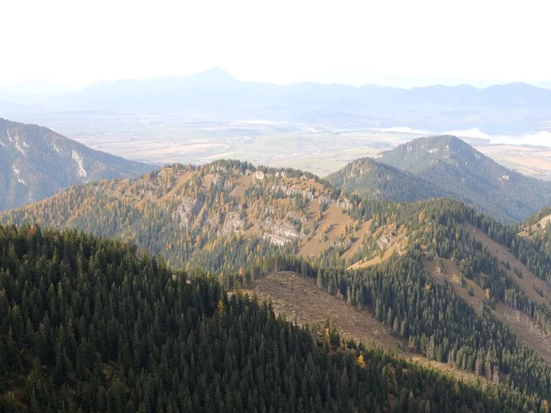
So far the route may not have been the prettiest, but what follows more than makes up for it. From here, a path to Ďumbier winds across small mountain meadows covered with blueberry bushes, through dense dwarf pine and low woodland, and finally along a grassy ridge.
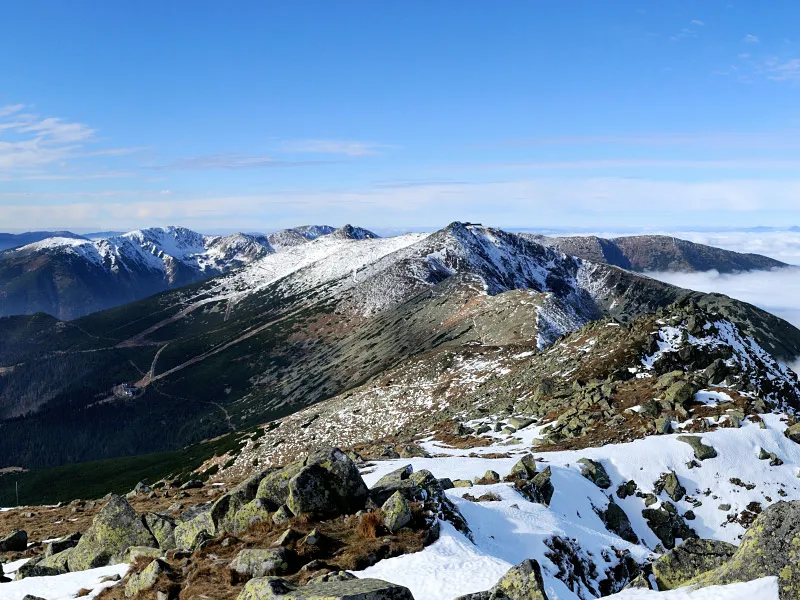
From the saddle, turn right and follow the yellow trail as you begin climbing toward Tanečnica (1,681 m), bypassing the summit on the right. Here, for the first time, panoramic views open up over the main ridge of the Low Tatras, which looks far more majestic from this side than from the south. With these views ahead of you, descend about 100 vertical metres, only to regain them on the climb up Prašivá.
A short descent follows, then a long climb through dwarf pine onto the grassy, gently rising northern ridge of Krúpova hoľa. Although you will see a path heading straight up toward Krúpova hoľa, it is not the marked route, so at the junction below it you should turn right and ascend on the blue trail in switchbacks from the pod Krupovou hoľou junction.
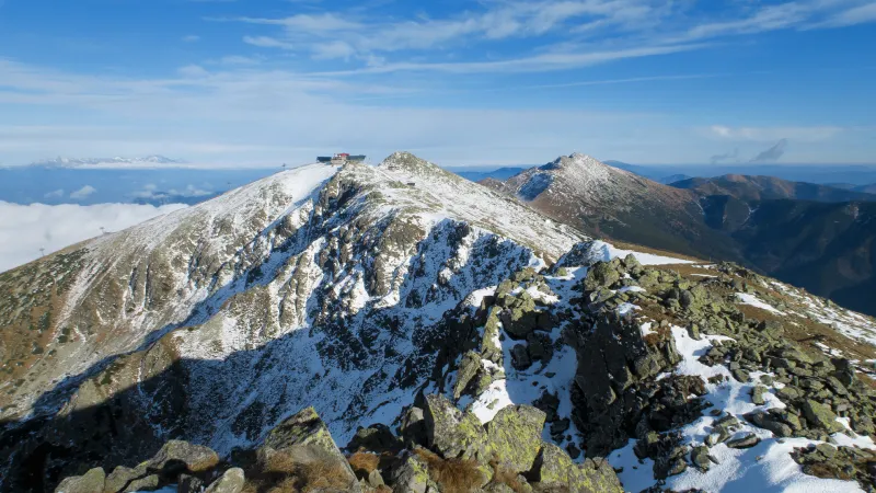
This brings you to Krúpové Saddle (1,925 m), from which a red-marked spur leads to the summit of Ďumbier (2,043 m). Most of the route is paved with huge stones. At first it runs right along the ridge and here and there takes you to the very edge of a deep rocky drop. After a while it bends slightly right and leads to the summit across a slope covered with grass and many large rocks.
From the summit of Ďumbier there are magnificent views of almost the entire ridge of the High Tatras, starting with Slavkovský štít on the far right, then Gerlachovský štít, Vysoká, Kriváň and Svinica, beyond which the Western Tatras begin, with well-known peaks such as Bystrá, Klín, Baranec, Tri kopy, Baníkov, Pachola and Sivý vrch on the far left. You can also see landmarks such as Veľký Choč and Malá Fatra. Looking west along the ridge, you will see Chopok, Dereše and Chabenec.
The return follows the same route at first via Krúpové Saddle, then along the green trail back down in switchbacks to the junction below Krúpova hoľa. From there continue on the green trail all the way down into Široká dolina to the záver Širokej doliny junction (1,416 m), then on a wide forest track descending gently to the pod Krčahovom junction, from where you already know the way back to Lúčky.